
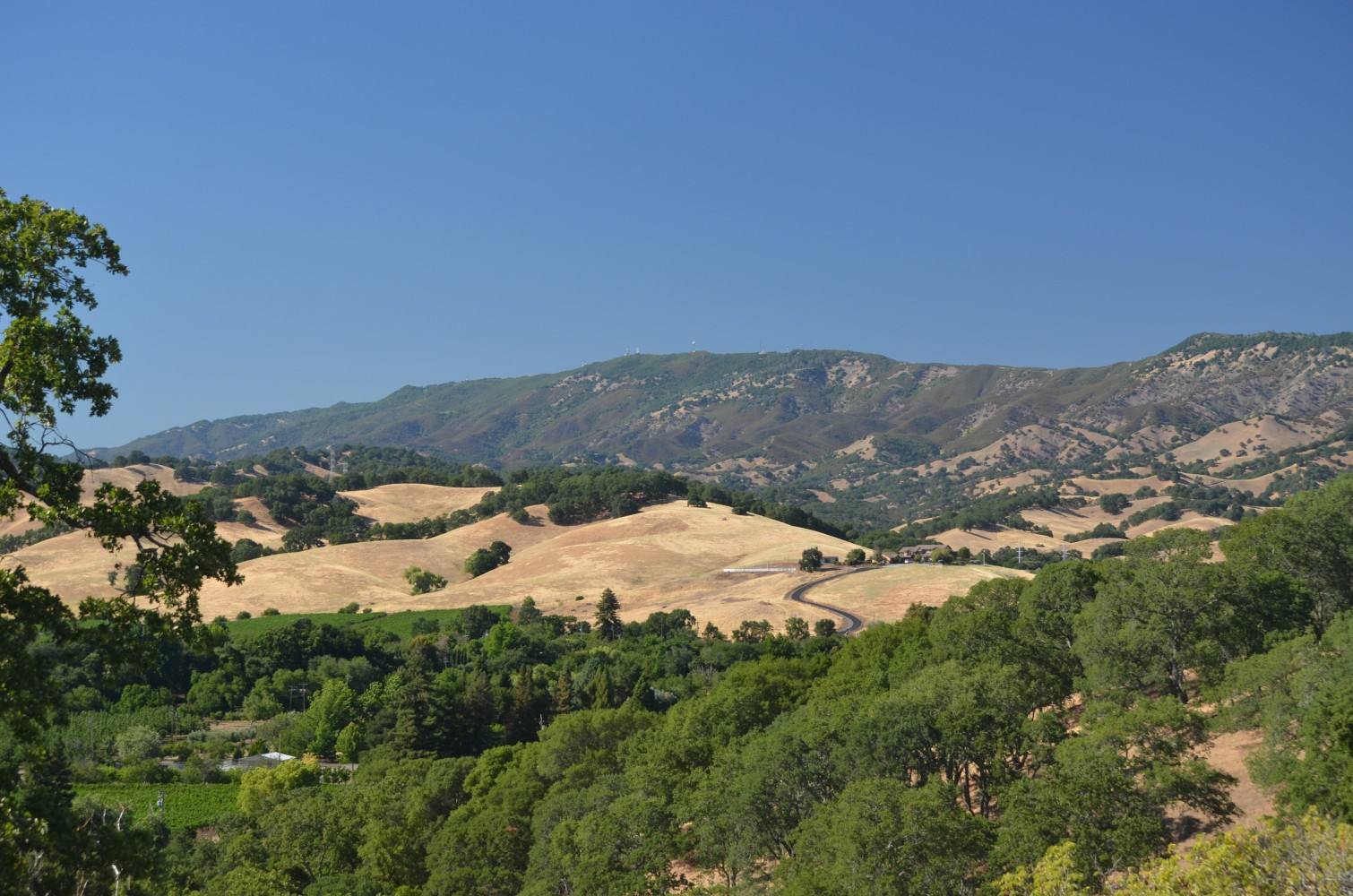
Photo above: Mount Vaca and the Blue Ridge in the hills west of Vacaville, Solano County, California, June 2013. Mikesclark, CC BY-SA 3.0, via Wikimedia Commons.

Maybe, and you check it one address at a time. Vacaville adopted CAL FIRE’s new fire hazard severity zones on June 10, 2025, rating parts of the city moderate, high or very high, and the Solano County Office of Emergency Services posts a searchable map. A zone on that map does not decide your insurance on its own, but insurance can still be the hard part, so get quotes early.
Here’s what changed, how to look up a house, and where to take the insurance question.
What changed on Vacaville’s fire map in 2025?
The state redrew it, and the city had to adopt it. The Office of the State Fire Marshal, part of CAL FIRE, released new maps for local areas in four phases in 2025. Vacaville was in Phase 2 and received its recommended map on February 24, 2025 (City of Vacaville, letter to CAL FIRE, May 29, 2025; OSFM Fire Hazard Severity Zones page, checked September 24, 2026).
The steps after that:
- Comment period to April 1, 2025. The city posted the proposed map and took public comments (City of Vacaville Fire Department, LRA FHSZ page, checked September 24, 2026).
- April 8, 2025. Council study session on the map (City staff report, June 10, 2025).
- May 27, 2025. Council introduced the ordinance, 4 to 2, and approved a letter to CAL FIRE’s chief (City Council minutes, May 27, 2025).
- June 10, 2025. Council adopted Ordinance No. 2004, 5 to 2, designating the zones as the State Fire Marshal recommended, with no changes (City Council minutes and staff report, June 10, 2025). The staff report says ordinances take effect 30 days after final passage.
Why no changes? The city’s page says it “does not control the creation of the map.” State law gives a city 120 days to adopt the zones and only lets it raise a zone or widen one, never lower it (City of Vacaville, LRA FHSZ page; Ordinance No. 2004).
Did the city agree with the map?
Not fully. In a May 29, 2025 letter, the mayor wrote on behalf of the council that many parcels in Centennial Park were mapped moderate despite the city’s fire work there, and asked CAL FIRE to meet with the city’s fire chief (City of Vacaville, letter to CAL FIRE, May 29, 2025).
The state’s June 3, 2025 reply said the maps show long-term hazard and do not reflect short-term fuel changes from treatment work, and that state law does not allow an appeal of a zone (CAL FIRE Office of the State Fire Marshal, letter to Mayor Carli, June 3, 2025). So the map is what it is. Your job as a buyer is to know where your address lands.
How do I look up the zone for a Vacaville address?
Use one of two official maps.
- Inside city limits: the City of Vacaville’s fire department page links a searchable map on the Solano County Office of Emergency Services portal at oes.maps.arcgis.com. Type the address and read the color on that parcel.
- Anywhere in California, including county land outside the city: the State Fire Marshal’s Fire Hazard Severity Zone viewer, linked from osfm.fire.ca.gov. The state’s maps for State Responsibility Areas, mostly unincorporated land the state protects, took effect April 1, 2024 (OSFM, checked September 24, 2026).
Two details worth knowing. If a parcel falls in two zones, Ordinance No. 2004 says the higher zone applies to the whole parcel. And not sure whether a house is inside city limits? City Coach links the city’s own address lookup at data-cov.opendata.arcgis.com.
Questions about how the state drew the map go to the Office of the State Fire Marshal at [email protected] or (916) 633-7655 (City of Vacaville, LRA FHSZ page).
What does a zone actually measure?
Hazard, not risk. The State Fire Marshal says the zones look at physical conditions like fuel, slope and fire weather over a 30 to 50 year period, without counting home hardening, recent fires or brush clearing. Risk is the damage a fire could do with those things counted (OSFM, Fire Hazard Severity Zones page, checked September 24, 2026).
That is why a well-kept street can still be mapped high. It is also why the map alone can’t tell you how a specific house would fare.
The hills around Vacaville have burned before. In August 2020 the LNU Lightning Complex fire destroyed structures on English Hills Road in Vacaville (CapRadio, August 19, 2020).
Will a fire zone show up in the disclosures?
A high or very high zone will. California’s Natural Hazard Disclosure form, Civil Code 1103.2, has a line for a high or very high fire hazard severity zone, and it notes the owner must follow the state’s defensible space rules. It also has a separate line for wildland areas with forest fire risks (California Legislative Information, Civil Code 1103.2, amended effective January 1, 2025, checked September 24, 2026). State law separately requires a seller to disclose when a home is in a very high zone (Government Code 51183.5).
A moderate zone is not one of the boxes on that form. So a home can be mapped moderate and the disclosure can still read “no.” Look it up yourself. For anything legal in a disclosure, ask a real estate attorney.
Can I get homeowners insurance on a Vacaville house in a fire zone?
It depends on the house and the insurer, and only a licensed insurance agent or broker can tell you what’s available and what it will cost. We’re not insurance agents, and we don’t advise on coverage. What we can do is point you to the official sources.
What the state says about the map. The California Department of Insurance says CAL FIRE’s hazard maps are not used for insurance rates or underwriting. Insurers use their own wildfire catastrophe models to decide where to write policies and how much to charge (CDI consumer alert and Q and A, posted on the OSFM Fire Hazard Severity Zones page, checked September 24, 2026).
What Vacaville residents told the council. In that same May 29, 2025 letter, the council wrote that residents were telling it their coverage was being affected anyway (City of Vacaville, letter to CAL FIRE). Both things can be true. The map is not the insurer’s tool, but the same hills show up in the insurer’s model.
If no regular insurer will write it. The California FAIR Plan offers basic fire coverage when regular insurers will not. It calls itself an insurer of last resort. You apply through a licensed agent or broker, who first searches the regular market, and a separate Difference in Conditions policy can add coverage the FAIR Plan leaves out (California FAIR Plan, cfpnet.com, checked September 24, 2026).
Help with a problem. The Department of Insurance consumer hotline is 800-927-4357, and its site at insurance.ca.gov has a tool to find licensed brokers (CDI, checked September 24, 2026).
When should I get insurance quotes on a Vacaville home?
Before you remove contingencies. Ask your insurance agent for a quote on the exact address in the first days of escrow, while you can still walk away or renegotiate. If the only option is the FAIR Plan plus a second policy, you want to know that before closing, not after.
What can I do to lower the fire hazard around a house?
Start with the yard and roof. The Department of Insurance says its Safer from Wildfires rules require insurers to give discounts for certain home-hardening and community wildfire work (CDI Q and A, checked September 24, 2026). Ask your insurance agent which steps count for your policy.
If you’re buying on the edge of town, walk the property line. Look at the slope behind the house, what grows on it, and how close it gets to the eaves.
Questions people also ask
When did Vacaville adopt the new fire hazard zones?
The City Council adopted Ordinance No. 2004 on June 10, 2025, by a 5 to 2 vote, designating the moderate, high and very high zones recommended by the State Fire Marshal. The staff report says ordinances take effect 30 days after final passage. The city received the recommended map on February 24, 2025, per city records checked September 24, 2026.
Can Vacaville lower my home’s fire zone?
No. Ordinance No. 2004 notes that state law only lets a city raise a zone or widen one. The State Fire Marshal also wrote to the mayor on June 3, 2025 that the law does not allow an appeal of a zone. Questions about the map go to [email protected] or (916) 633-7655.
Does a fire hazard zone raise my insurance rate?
The California Department of Insurance says the CAL FIRE maps are not used for insurance rates or underwriting, and that insurers use their own wildfire risk models. Those models can still weigh the same terrain. For a quote on a specific Vacaville address, talk to a licensed insurance agent or broker early in escrow.
What is the California FAIR Plan?
It is a pool that sells basic fire insurance when regular insurers won’t, and it calls itself an insurer of last resort. You apply through a licensed agent or broker after they search the regular market. A separate Difference in Conditions policy can fill gaps, per cfpnet.com, checked September 24, 2026.
Your next step
Send us the Vacaville address you’re looking at. We’ll pull the fire zone, the disclosure report and recent sales nearby, and remind you when to line up your insurance quote. Ask a Vacaville agent on our team or call (510) 949-5525.
More on Vacaville: Is Vacaville, CA a good place to live? · How much does a house cost in Vacaville? · What’s my home worth?
By Bill Davis, DRE #01880656, The Davis Team at eXp Realty, Vacaville, CA. Updated September 24, 2026.
Sources
- City of Vacaville Fire Department, Local Responsibility Area/Fire Hazard Severity Zone Update page, with link to the Solano County OES searchable map: cityofvacaville.gov (checked September 24, 2026)
- City of Vacaville, City Council minutes, May 27, 2025 (approved June 10, 2025): vacaville.granicus.com
- City of Vacaville, staff report and Ordinance No. 2004, and City Council minutes, June 10, 2025: vacaville.granicus.com (checked September 24, 2026)
- City of Vacaville, council letter to CAL FIRE Director Joe Tyler, May 29, 2025, and CAL FIRE Office of the State Fire Marshal reply, June 3, 2025: cityofvacaville.gov
- CAL FIRE Office of the State Fire Marshal, Fire Hazard Severity Zones page and FHSZ viewer: osfm.fire.ca.gov (checked September 24, 2026)
- California Department of Insurance, “CAL FIRE hazard maps do not affect insurance rates or availability” and “Q and A, Insurance and CAL FIRE Fire Hazard Severity Zone Maps,” posted on the OSFM page (checked September 24, 2026)
- California FAIR Plan: cfpnet.com (checked September 24, 2026)
- California Department of Insurance: insurance.ca.gov, 800-927-4357 (checked September 24, 2026)
- California Civil Code 1103.2 and Government Code 51183.5: leginfo.legislature.ca.gov (checked September 24, 2026)
- CapRadio, LNU Lightning Complex evacuations in Vacaville, August 19, 2020: capradio.org