
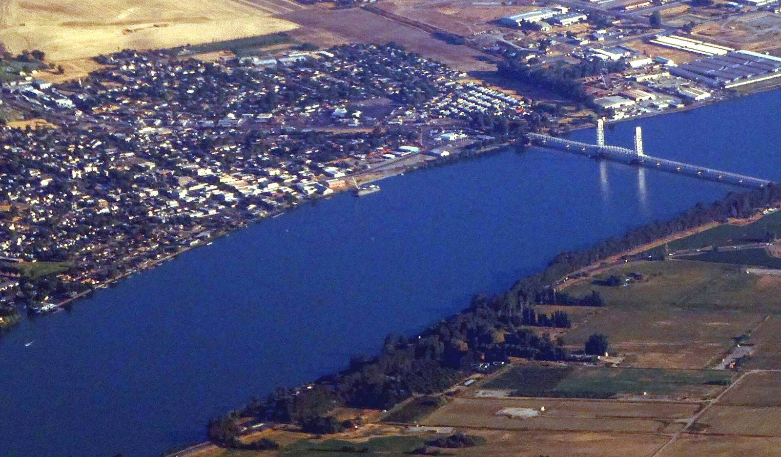
Photo above: Aerial view of Rio Vista, California, the Sacramento River and the Rio Vista Bridge, September 2024. Pi.1415926535, CC BY-SA 4.0, via Wikimedia Commons.

It depends on the address. FEMA’s current map for Rio Vista shows high-risk flood zones (A, AE, AO and a floodway) in parts of the city, while most of the area inside city limits is mapped Zone X, FEMA’s minimal flood hazard label (FEMA National Flood Hazard Layer, read September 25, 2026; the share is our estimate, explained below). If a home is in a high-risk zone and you use a government-backed mortgage, flood insurance is required.
So don’t guess from the listing. Check the exact address in three places, then get a quote. Here’s how.
How do I check the flood zone for a Rio Vista address?
Three free lookups, about ten minutes.
- FEMA’s Flood Map Service Center. Go to msc.fema.gov, type in the address, and open the map. Note the zone letter. That’s the one lenders use.
- DWR’s levee lookup. The California Department of Water Resources lists Rio Vista among the cities in its Levee Flood Protection Zones, and its address lookup at gis.lfpz.water.ca.gov shows whether a property is in one (DWR, Flood Risk Notification page, checked September 25, 2026). You can also call DWR at 1-877-769-7475.
- The seller’s Natural Hazard Disclosure. California requires the seller or agent to disclose whether a home is in a FEMA special flood hazard area (any Zone A or V) or an area of potential flooding (Civil Code 1103, checked September 25, 2026). Read it closely, before your inspection contingency ends.
If two of these don’t match, ask your agent to sort it out before you go further.
What flood zones are in Rio Vista?
Several. When we queried FEMA’s flood map data for the city on September 25, 2026, the zones inside Rio Vista’s boundary were:
| FEMA zone | What FEMA means by it |
|---|---|
| A | High risk (1% annual chance flood), no base flood elevation set |
| AE | High risk, with a base flood elevation |
| AE floodway | The channel and nearby land kept open to carry floodwater |
| AO | High risk, shallow flooding |
| X, shaded | Moderate risk (0.2% annual chance flood) |
| X, unshaded | Minimal flood hazard |
Our own estimate, not a FEMA figure: we overlaid FEMA’s flood hazard zone layer on the Census Bureau’s boundary for Rio Vista city (TIGERweb) on September 25, 2026 and measured the area in each zone. About 78% of the area was unshaded Zone X and about 22%, roughly a fifth, was in the high-risk A, AE and AO zones. That boundary includes some river water, and area isn’t homes, so a street or a house can differ. Your address is the only answer that counts.
How old is Rio Vista’s flood map?
The currently effective FEMA flood map for the City of Rio Vista is dated May 4, 2009. The city’s first Flood Insurance Rate Map dates to May 19, 1981 (FEMA, NFIP Community Status Book data for community 060371, record refreshed August 25, 2026, checked September 25, 2026). FEMA’s map data also shows a map revision (a LOMR) that took effect August 7, 2009.
Maps can change. If FEMA revises them, a home’s zone, and its insurance requirement, can change with it. Check the map again right before you buy.
Do I need flood insurance to buy a house in Rio Vista?
If the home is in a high-risk zone and your mortgage is from a government-backed lender, yes. FEMA says homes in high-risk flood areas with mortgages from government-backed lenders are required to have flood insurance (FEMA, flood insurance page, checked September 25, 2026). A lender can also require it in other cases.
Outside the high-risk zones it’s usually your choice. Floods can happen outside the mapped zones, so get a quote either way and decide with real numbers.
Timing matters. FEMA says a new flood policy typically has a 30-day waiting period before it takes effect, with exceptions, including when a policy is required by a lender at closing (same FEMA page). Tell your insurance agent your closing date early.
Can I get a flood insurance discount in Rio Vista?
Not through the city’s rating, based on FEMA’s records. The City of Rio Vista participates in the National Flood Insurance Program, but FEMA’s record shows no Community Rating System class for it, so no community-wide discount is listed (FEMA NFIP record, checked September 25, 2026). Ask an insurance agent about quotes from both the NFIP and private flood insurers, and whether an elevation certificate would change your price.
What about the levees around Rio Vista?
They’re part of the picture, and the state tracks them. DWR mails flood risk notices every September to properties in its Levee Flood Protection Zones, and Rio Vista is on its list of cities in those zones (DWR, Flood Risk Notification page, checked September 25, 2026).
There’s also levee work proposed nearby. DWR describes the Little Egbert project, about 3,150 acres immediately upstream of the City of Rio Vista, proposed by Reclamation Districts 536 and 2084, that would improve or repair existing State Plan of Flood Control levees. DWR said environmental review was underway as of May 2025 (DWR, Little Egbert Multi-Benefit Project page, checked September 25, 2026).
We don’t rate levees or predict floods. For a specific home, the FEMA zone, the DWR lookup and the insurance quote are the facts to decide on.
I’m renting in Rio Vista. Does my landlord have to tell me?
Yes, on leases signed on or after July 1, 2018. California Government Code 8589.45 requires landlords to disclose in the lease if they know the property is in a special flood hazard area or an area of potential flooding (checked September 25, 2026). Renters’ insurance usually doesn’t cover flood, so ask about contents flood coverage.
Questions people also ask
Is all of Rio Vista in a flood zone?
No. FEMA’s flood map data, read September 25, 2026, shows high-risk Zones A, AE, AO and a floodway in parts of Rio Vista, and moderate or minimal risk Zone X across most of the area inside city limits (our estimate from FEMA’s map data). The zone is set address by address, so look up the exact home on FEMA’s Flood Map Service Center at msc.fema.gov before you make an offer.
How much is flood insurance in Rio Vista?
It depends on the home, its zone, its elevation and the policy, so there’s no one number, and we don’t quote insurance prices. Get quotes from an insurance agent for both NFIP and private flood policies before your contingencies end. An elevation certificate may change the price. FEMA’s record shows no community discount class for Rio Vista.
When was the Rio Vista flood map last updated?
FEMA’s currently effective flood map for the City of Rio Vista is dated May 4, 2009, per FEMA’s NFIP community record for community 060371, checked September 25, 2026. FEMA’s map data also shows a revision effective August 7, 2009. If FEMA updates the map, zones can change, so check the address again right before you buy.
Does the seller have to tell me if a Rio Vista home is in a flood zone?
Yes. California Civil Code 1103 requires the seller or the seller’s agent to disclose on the Natural Hazard Disclosure statement whether the home is in a FEMA special flood hazard area or an area of potential flooding. Read it before your contingencies end, and compare it with FEMA’s map. For legal questions about disclosures, ask a real estate attorney.
Your next step
Found a Rio Vista home you like? Send us the address. We’ll pull the FEMA zone, the DWR lookup and the disclosure with you, and connect you with an insurance agent for a quote before you commit. Talk with our team about Rio Vista or call (510) 949-5525.
More on Rio Vista: Is Rio Vista a good place to live? · How much does a house cost in Rio Vista? · Selling a home in Rio Vista · What’s my home worth?
By Bill Davis, DRE #01880656, The Davis Team at eXp Realty, Rio Vista, CA. Updated September 25, 2026.
Sources
- FEMA, National Flood Hazard Layer map service (flood hazard zones, FIRM panels and LOMR layers for Solano County, community 060371): hazards.fema.gov/arcgis/rest/services/public/NFHL/MapServer (read September 25, 2026). The share of area by zone is The Davis Team’s own estimate: FEMA flood hazard zones (layer 28) clipped to the Census Bureau TIGERweb boundary for Rio Vista city (GEOID 0660984) and measured by area, September 25, 2026.
- FEMA, OpenFEMA NFIP Community Status Book, City of Rio Vista, community 060371 (record refreshed August 25, 2026): fema.gov/api/open/v1/NfipCommunityStatusBook (checked September 25, 2026)
- FEMA Flood Map Service Center: msc.fema.gov
- FEMA, Flood Insurance: fema.gov/flood-insurance (checked September 25, 2026)
- California Department of Water Resources, Flood Risk Notification: water.ca.gov/Programs/Flood-Management/Community-Resources/Flood-Risk (checked September 25, 2026)
- California Department of Water Resources, Little Egbert Multi-Benefit Project: water.ca.gov/Programs/All-Programs/Multibenefit/Little-Egbert (checked September 25, 2026)
- California Civil Code 1103 and Government Code 8589.45: leginfo.legislature.ca.gov (checked September 25, 2026)