
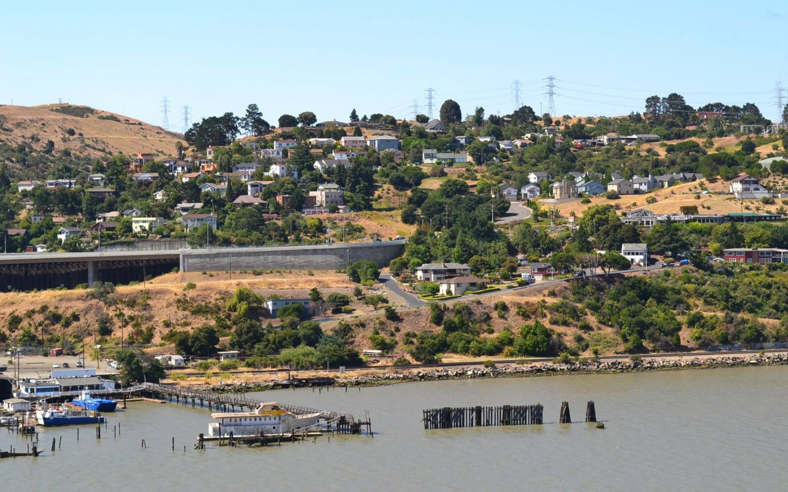
Photo above: Homes on the hillside above the waterfront in Crockett, California, July 2010. Federico Pizano, CC BY 3.0, via Wikimedia Commons.

It depends on the lot, and you can check it. Look up the address on the state’s official earthquake hazard map, read the Natural Hazard Disclosure in escrow, look at the county’s landslide map, and have a geotechnical engineer look at any steep or cracked lot before you remove your inspection contingency.
A lot of Crockett sits on hills above the Carquinez Strait. That’s part of the view. It also means the ground under the house deserves its own inspection.
Why ask about landslides in Crockett at all?
Because so much of the town is built into the slope. Streets climb from the waterfront up toward Crockett Hills Regional Park, and many lots are steep. Steep ground plus winter rain is the combination that moves soil. That doesn’t mean a given house has a problem. It means you should check instead of guessing.
How do I check if a Crockett address is in a state landslide zone?
Use EQ Zapp from the California Geological Survey. It is a free online map where you type an address and see whether the property falls in any of the state’s official earthquake hazard zones: fault rupture, liquefaction, or earthquake-induced landslides (California Geological Survey, EQ Zapp page, checked September 25, 2026).
The official state zone maps that cover the Crockett area are the Benicia quadrangle, released November 21, 2024 (Seismic Hazard Zone Report 138), and the Mare Island quadrangle, released February 22, 2024 (Seismic Hazard Zone Report 134) (California Geological Survey, Landslide Zones data, checked September 25, 2026). Those maps include earthquake-induced landslide zones. Whether a given address is inside one is something only the lookup can tell you, so check the exact address.
Two things to know about the result:
- A “yes” is a flag, not a verdict. In a mapped zone, the state requires a site-specific study before new construction is approved (California Geological Survey, landslides page, checked September 25, 2026).
- A “no” is not a clean bill of health. The state map shows zones where official maps exist. It does not replace a look at the actual lot.
What maps show past landslides near Crockett?
Two public sources are worth a few minutes.
- The California Landslide Inventory. The Geological Survey’s online map shows landslides mapped by the Survey and others over the past 50 years. It also runs a database of reported landslides from agencies, news and the public, and a statewide map of susceptibility to deep-seated landslides, Map Sheet 58, first published in May 2011 (California Geological Survey, landslides page and Map Sheet 58 metadata, checked September 25, 2026).
- The county’s landslide map. Contra Costa County’s 2045 General Plan, adopted by the Board of Supervisors on November 5, 2024, includes Figure HS-18b, Landslide Hazards, in its Health and Safety Element. It maps past landslides and landslide susceptibility and is used when the county reviews projects (Contra Costa County, 2045 General Plan, checked September 25, 2026).
Look at where the house sits on each map, then take what you find to the engineer.
What will the seller have to tell me?
In California, the seller gives you a Natural Hazard Disclosure statement. It includes a line for whether the property is in a state seismic hazard zone, with separate boxes for a landslide zone and a liquefaction zone (California Civil Code section 1103.2, checked September 25, 2026). The seller’s own disclosures should also mention known past movement, drainage problems or repairs.
Read them carefully and ask for any reports the seller has, such as an old geotechnical report, a retaining wall permit, or a drainage repair invoice. If a disclosure term confuses you, ask a real estate attorney.
Who should inspect a hillside lot?
A geotechnical engineer or a certified engineering geologist, in addition to your general home inspector. A home inspector looks at the house. A geotechnical engineer looks at the ground: slope, soil, drainage and retaining walls. We don’t evaluate slopes, and neither should anyone else who isn’t licensed to.
Things worth pointing out to them on a Crockett lot:
- Cracks in the foundation, garage slab, driveway or retaining walls
- Doors and windows that stick on the downhill side
- Leaning fences, walls or trees
- Water pooling against the house, or downspouts that empty onto the slope
- Fill added to make a flat yard
Build the time for this into your inspection period. A good report can take more than a few days to schedule.
Does landslide risk affect insurance and permits?
Often, yes. The California Department of Insurance says standard homeowners policies generally exclude earth movement, including landslides (California Department of Insurance, consumer fact sheet on flood, mudslide and landslide coverage, February 4, 2025). Ask your insurance agent what is and isn’t covered before you close. For an addition, a new retaining wall or grading, permits come from the county, because Crockett is unincorporated. The county’s Department of Conservation and Development handles building permits through its online ePermits Center, and a lot in a mapped zone may need a geotechnical study with the application.
Questions people also ask
How do I find out if my Crockett home is in a landslide zone?
Type the address into EQ Zapp, the California Geological Survey’s free online map. It shows whether the property is in an official earthquake-induced landslide zone, a liquefaction zone or a fault zone. Then compare the county’s 2045 General Plan landslide map, Figure HS-18b. For a real answer about the lot itself, hire a geotechnical engineer.
Does the seller have to disclose landslide zones in California?
Yes, for mapped state zones. The Natural Hazard Disclosure statement under California Civil Code section 1103.2 asks whether the property is in a seismic hazard zone and has separate boxes for landslide and liquefaction zones. Sellers also have to share known material facts. For questions about what a disclosure means, talk to a real estate attorney.
Does homeowners insurance cover landslides?
Usually not. The California Department of Insurance says standard homeowners policies generally exclude earth movement, including landslides, in its February 4, 2025 consumer fact sheet. There are exceptions, for example when a covered peril such as a wildfire caused the slide. Ask your insurance agent in writing what the policy on a specific Crockett home would cover before you remove your contingencies, and get quotes early in escrow.
Who inspects a hillside lot for landslide risk?
A licensed geotechnical engineer or certified engineering geologist. They look at the slope, soil, drainage and retaining walls, which a general home inspector does not evaluate. Point out any cracks, sticking doors, leaning walls or added fill. Schedule them early in your inspection period, since good ones can book up.
Your next step
Found a Crockett home on a hill? Send us the address. We’ll help you gather the hazard map results, the disclosures and the names of local geotechnical engineers so you can decide with facts. Talk with our team about Crockett or call (510) 949-5525.
More on Crockett: Is Crockett a good place to live? · Selling a home in Crockett · Search Crockett homes
By Bill Davis, DRE #01880656, The Davis Team at eXp Realty, Crockett, CA. Updated September 25, 2026.
Sources
- California Geological Survey, EQ Zapp: conservation.ca.gov/cgs/geohazards/eq-zapp (checked September 25, 2026)
- California Geological Survey, Landslides page (California Landslide Inventory, Reported Landslides Database, Map Sheet 58): conservation.ca.gov/cgs/landslides (checked September 25, 2026)
- California Geological Survey, Landslide Zones data (Benicia quadrangle released November 21, 2024, SHZR 138; Mare Island quadrangle released February 22, 2024, SHZR 134): gis.data.ca.gov (checked September 25, 2026)
- California Geological Survey, Map Sheet 58, Susceptibility to Deep-Seated Landslides in California, May 2011: maps.conservation.ca.gov/cgs/metadata/MS58.html (checked September 25, 2026)
- Contra Costa County, 2045 General Plan, Health and Safety Element, Figure HS-18b Landslide Hazards: contracosta.ca.gov/4732 (checked September 25, 2026)
- California Department of Insurance, consumer fact sheet on insurance coverage for flood, mudflow, mudslide and landslide, February 4, 2025: insurance.ca.gov
- California Civil Code section 1103.2, Natural Hazard Disclosure Statement: leginfo.legislature.ca.gov (checked September 25, 2026)
- Contra Costa County Department of Conservation and Development, permits: contracosta.ca.gov (checked September 25, 2026)