
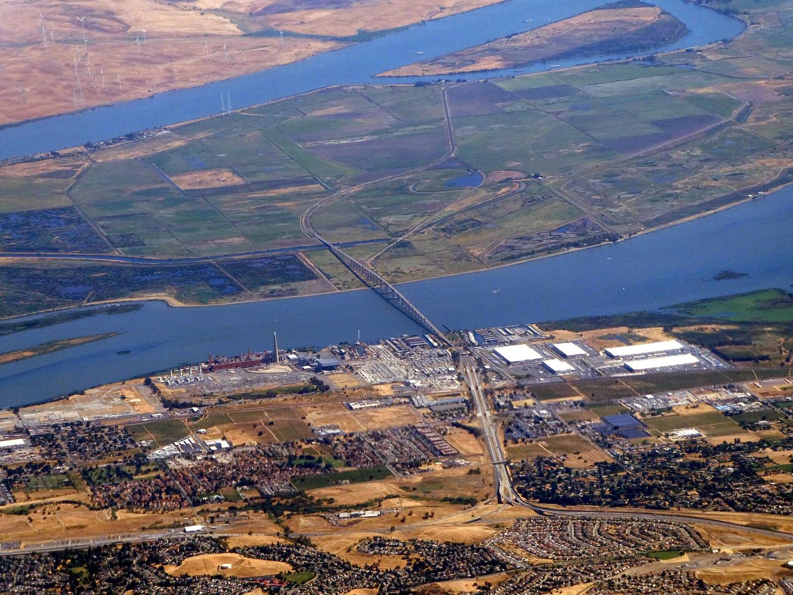
Photo above: Aerial view of the Antioch Bridge over the San Joaquin River, with levee-ringed Delta farm islands beyond and the East Contra Costa shoreline in front, May 2025. Pi.1415926535, CC BY-SA 4.0, via Wikimedia Commons.

It depends on which side of town. FEMA’s flood study says “The northern portion of the City Oakley is subject to delta flooding via the San Joaquin River,” and the lower reaches of the Marsh Creek channel also run through the city (FEMA, Flood Insurance Study for Contra Costa County, revised March 21, 2017).
So a home near Main Street and a home off East Cypress Road can have very different flood pictures. Check the exact address on FEMA’s map, then find out whether a levee district protects it. Here’s how.
How do I look up the flood zone for an Oakley address?
Go to FEMA’s Flood Map Service Center at msc.fema.gov/portal/search and type in the full street address. The map that comes up shows the zone for that spot. Oakley’s community number in the National Flood Insurance Program is 060766 (FEMA, Flood Insurance Study, 2017), and you’ll see it on flood reports and insurance quotes.
Look at the whole lot, not just the pin. Then look for map changes. FEMA’s study lists a Letter of Map Revision for the City of Oakley named “Summer Lake,” case 10-09-3624P, effective December 24, 2010 (same FEMA study). If you’re looking in that part of town, ask your agent or an insurance agent to pull the current map panel and any revision that covers the parcel.
What do the zone letters mean?
FloodSmart, the National Flood Insurance Program’s public site, sorts them like this (FloodSmart, “What is my flood zone?”, checked September 25, 2026):
- Zones starting with A, such as A or AE: high risk. In communities in the program, homeowners with federally backed mortgages must buy flood insurance.
- Zone B or shaded X: moderate risk. FloodSmart says these areas may have lowered their risk with measures such as levees, or see shallow flooding.
- Zone C or unshaded X: minimal risk, usually above the 500-year flood level, but not zero.
- Zone D: risk not determined, because no flood study was done.
That shaded X detail matters in Oakley. A levee can lower the mapped risk. It doesn’t erase it.
Why do levees matter so much here?
Because the Delta sits below the water next to it. FEMA’s study says the Delta was reclaimed with about 1,100 miles of levees splitting it into about 120 tracts called islands, that many islands are 15 to 25 feet below sea level because the peat soil has sunk, and that Delta island flooding has usually come from a levee failing before water ever went over the top (FEMA, Flood Insurance Study, 2017, section 2.3).
In plain terms, on land behind a Delta levee, the levee’s condition is the flood story.
Which Oakley areas depend on levees?
The east side along East Cypress Road, based on what the city and the levee district publish:
- Hotchkiss Tract. Reclamation District 799 is the levee agency. In January 2026 it filed a Mitigated Negative Declaration with the state for the Hotchkiss Tract Levee Rehabilitation Project, to rehabilitate the Dutch Slough levee to the Department of Water Resources Bulletin 192-82 agricultural standard. The filing lists Dutch Slough Road and Jersey Island Road as cross streets, 8.9 acres, and a state review period of January 23 to February 23, 2026 (CEQAnet, SCH 2026010778, checked September 25, 2026).
- Summer Lake North. Its special tax includes $548.76 per built single-family parcel for fiscal year 2025/26 for RD 799 services, including levees, drainage pump stations and storm drainage (City of Oakley, CFD 2022-2 annual report, filed January 13, 2026).
- Cypress Grove. Its special tax district was formed in 2005 to pay for upkeep of the levee system, stormwater pond, pump, force main and outfall that serve the tract (City of Oakley, staff report, January 13, 2026).
We don’t have an official source that says whether FEMA accredits these levees on the current map, so we won’t guess. Ask RD 799 at (925) 684-2398 about the levee that protects the parcel you like (CEQAnet lists that number for the district).
What is the flood picture on the Marsh Creek side?
Different. FEMA’s study says the lower reaches of the Marsh Creek channel run through Oakley, and that the county flood control district’s Marsh-Kellogg Watershed Plan improved Marsh, Sand and Deer Creek channels built to carry the 2-percent annual chance flood, sometimes called the 50-year flood (FEMA, Flood Insurance Study, 2017, section 2.4). A 2-percent design is smaller than the 1-percent flood the high-risk zones are drawn around. If a home backs onto the creek, look closely at the map for that lot.
How do people get out of the East Cypress area in an emergency?
The city publishes a backup route. For an evacuation of the East Cypress Corridor, Bethel Island and Summer Lake area, the route runs from East Cypress Road south on Sandmound Boulevard to a small levee road, over a land dam across Sandmound Slough to Holland Tract Road, then Delta Road toward Knightsen, Oakley and Brentwood. It’s for passenger cars only, no RVs or trailers. The police department can open it under agreements with RD 799 and RD 2025 (City of Oakley, Evacuation Information page, checked September 25, 2026).
The same page says the city is widening East Cypress Road from Knightsen Avenue to Bethel Island Road, to six lanes west of Jersey Island Road and four lanes east of it, by the end of calendar year 2026. To get alerts, text 94561 to 888-777 for the police department’s Nixle messages and register for the county’s Community Warning System.
Will I need flood insurance?
Your lender and the map decide. FloodSmart says that in program communities, flood insurance is mandatory in high-risk zones if the mortgage is government-backed. It also says nearly one-third of flood insurance claims from 2014 to 2024, 29%, came from outside high-risk areas (FloodSmart, “What is my flood risk?”, checked September 25, 2026).
We’re not insurance agents and don’t give insurance advice. Get a quote from a licensed insurance agent early in escrow, while you can still act on the number.
What will the seller’s disclosures show?
The Natural Hazard Disclosure Statement asks whether the property is in a FEMA Special Flood Hazard Area, meaning any Zone A or V, and whether it’s in an area of potential flooding on a dam failure inundation map (California Civil Code section 1103.2, checked September 25, 2026). Read it the day it arrives. Legal questions about it go to a real estate attorney.
Questions people also ask
Is Summer Lake in Oakley in a flood zone?
Look up the exact address on FEMA’s map at msc.fema.gov. FEMA’s 2017 flood study lists a map revision for Oakley called “Summer Lake,” case 10-09-3624P, effective December 24, 2010, and says northern Oakley is subject to Delta flooding via the San Joaquin River. The zone can differ lot by lot, so check the parcel, not the neighborhood.
Who maintains the levees in east Oakley?
Reclamation District 799 handles Hotchkiss Tract levees. In January 2026 it filed plans with the state to rehabilitate the Dutch Slough levee near Dutch Slough Road and Jersey Island Road, per CEQAnet. The City of Oakley’s Summer Lake North special tax sends $548.76 per built single-family parcel a year to RD 799 services, and Cypress Grove’s district pays for that tract’s levee upkeep.
Do I need flood insurance in Oakley?
It depends on the flood zone and your loan. FloodSmart says flood insurance is mandatory in high-risk A zones when the mortgage is government-backed. Outside those zones it’s usually your choice, though FloodSmart says 29% of claims from 2014 to 2024 came from outside high-risk areas. Ask a licensed insurance agent for a quote.
What is the Oakley evacuation route for Summer Lake?
The City of Oakley’s route for the East Cypress Corridor, Bethel Island and Summer Lake area goes south on Sandmound Boulevard, over a levee road and a land dam across Sandmound Slough to Holland Tract Road, then Delta Road toward Knightsen and Oakley. It’s for passenger cars only, per the city’s Evacuation Information page, checked September 25, 2026.
Your next step
Send us the address. We’ll pull the FEMA map panel, the tax bill lines for levee and drainage districts and the disclosure report, and walk through them with you before you commit. Talk to an Oakley agent on our team or call (510) 949-5525.
More on Oakley: Living in Oakley, CA · Oakley home prices right now · Search Oakley homes · What’s my home worth?
By Bill Davis, DRE #01880656, The Davis Team at eXp Realty, Oakley, CA. Updated September 25, 2026.
Sources
- FEMA, Flood Insurance Study, Contra Costa County, California and Incorporated Areas, Volume 1, revised March 21, 2017 (06013CV001C): FEMA Map Service Center, msc.fema.gov (downloaded September 25, 2026)
- FloodSmart (National Flood Insurance Program), “What is my flood zone?” and “What is my flood risk?”: floodsmart.gov (checked September 25, 2026)
- City of Oakley, Evacuation Information: oakleyca.gov/285 (checked September 25, 2026)
- CEQAnet, Hotchkiss Tract Levee Rehabilitation Project, Reclamation District 799, SCH 2026010778: ceqanet.opr.ca.gov (checked September 25, 2026)
- City of Oakley, staff report and fiscal year 2025/26 annual reports for CFD No. 1 and CFD No. 2022-2, January 13, 2026: City Council agenda packet, oakley.granicus.com (checked September 25, 2026)
- California Civil Code section 1103.2: leginfo.legislature.ca.gov (checked September 25, 2026)