
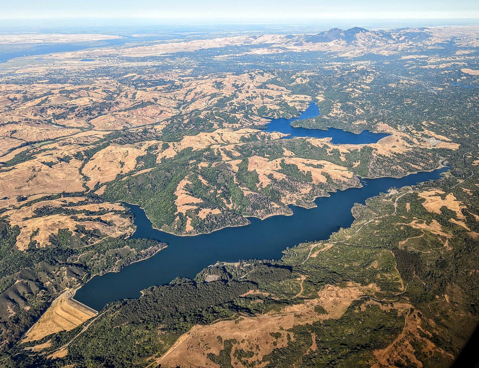
Photo above: Aerial view of San Pablo and Briones Reservoirs and the hills east of El Sobrante, Contra Costa County, 2022. Dicklyon, CC BY-SA 4.0, via Wikimedia Commons.

Some slopes are. In 2024 the California Geological Survey mapped the moderate to steep slopes of El Sobrante Ridge and San Pablo Ridge as zones where earthquake-induced landslides need a site investigation before new building. That’s a flag to check, not a verdict on any one house.
A hillside lot can be fine or it can be trouble, and the map alone won’t tell you which. Here’s how to check before you buy.
What does the state say about the El Sobrante hills?
The state has mapped them, in detail. The California Geological Survey’s Seismic Hazard Zone Report 134 covers the Richmond, Mare Island and San Quentin map quadrangles, and it names El Sobrante among the communities in the study area. The official map came out February 22, 2024, after a preliminary release on August 24, 2023 (CGS, Seismic Hazard Zone Report 134, 2024).
What it found:
- Landslide zones. About 9 square miles in the study area are zoned for earthquake-induced landslides, including the moderate to steep slopes of Pinole Ridge, El Sobrante Ridge and San Pablo Ridge.
- Past slides. The survey mapped 492 landslides in the study area, 480 of them in the Richmond quadrangle. Rock slides and earth flows were the most common types.
- Liquefaction zones on the flats. Low ground along San Pablo Creek and other valleys is zoned for liquefaction, where loose, wet soil can lose strength in strong shaking.
Same source for all three (CGS, Seismic Hazard Zone Report 134, read September 25, 2026).
Does a mapped zone mean the house will slide?
No. A zone means the state wants the ground investigated before new development, and it means the seller has to tell you. The report says the Seismic Hazards Mapping Act requires sellers of property in these zones to disclose it at the time of sale (CGS, Seismic Hazard Zone Report 134, 2024).
It says nothing about whether one particular house, retaining wall or foundation is sound. That takes someone looking at the actual lot.
How do I check a specific El Sobrante address?
Start with the free state lookup, then the paperwork.
- CGS EQ Zapp. Type in the address. It tells you whether the property is inside a mapped fault rupture, liquefaction or landslide zone, or whether the state hasn’t evaluated that spot yet (California Geological Survey, EQ Zapp page, checked September 25, 2026). The east side of the valley may fall on a different state map than the Richmond one. EQ Zapp shows whichever applies.
- The Natural Hazard Disclosure report. Ask for it early in escrow. Read the landslide and liquefaction lines, and compare them with what EQ Zapp showed you. If you have questions about what a seller must disclose, ask a real estate attorney.
- County permit history. For unincorporated parcels, Contra Costa County’s ePermits Center shows building permits and planning applications from January 1, 1980 forward. Plans aren’t online, but the county’s Records Research Division can look for them (Contra Costa County, Maps and GIS page, checked September 25, 2026). A retaining wall or foundation repair with a permit tells you something. One without a permit tells you something too.
- If the home is inside Richmond, the permit records are with the City of Richmond instead. Part of the El Sobrante Valley is inside Richmond city limits, so check which side a parcel is on first (Contra Costa County, El Sobrante page, checked September 25, 2026).
Who should inspect a hillside lot?
A licensed geotechnical engineer, for any home on a real slope. A general home inspector looks at the house. A geotechnical engineer looks at the ground under it: drainage, cracks in the soil, retaining walls, signs of creep. Ask for that inspection as a contingency in your offer, so you have time to read the report before you’re committed.
We don’t give engineering advice, and we won’t guess at what a crack means. For questions about disclosure duties or your contract, talk to a real estate attorney.
What warning signs can I spot on a showing?
You can’t diagnose a slope, but you can notice things worth asking about:
- Doors or windows that stick, or new cracks where walls meet the ceiling.
- Retaining walls that lean, bulge or have fresh patching.
- Fences, utility poles or trees tilting downhill.
- Wet spots or seeps on a slope in dry weather.
- Cracks in the driveway or street that line up across the lot.
Any one of these can have an ordinary cause. Write them down and hand the list to the engineer.
Is the county fixing slides on San Pablo Dam Road?
Yes, one of them. Contra Costa Public Works plans a storm drain and slide repair on San Pablo Dam Road about 200 feet southeast of La Honda Road. The plan includes a stitch pile wall, drainage repairs and guardrail, at an estimated $4,650,000 from the Federal Highway Administration’s Emergency Relief program and local gas tax. The county expects to advertise the job in fall 2026, build in spring or summer 2027 and finish in fall 2027. As of its August 2026 update, the county said the project was nearing 100%, environmental review (CEQA and NEPA) was cleared, and it was waiting on permits from state agencies (Contra Costa Public Works, project page, checked September 25, 2026).
That’s a road embankment, not a house. It’s a reminder that slopes along the valley can move, and it means lane work on a main route in 2027.
Should I check the fire map too?
Yes, while you’re looking at maps. Con Fire adopted CAL FIRE’s updated local fire hazard severity zone maps, effective July 10, 2025, with moderate, high and very high zones (Contra Costa County Fire Protection District, Fire Hazard Severity Zone page, checked September 25, 2026). Look up the lot on the state fire hazard map, and read the fire line on the Natural Hazard Disclosure report. Ask an insurance agent for a quote early, before your contingencies run out.
Questions people also ask
Is El Sobrante in a landslide zone?
Parts of it are. The California Geological Survey’s 2024 Seismic Hazard Zone Report 134 zones the moderate to steep slopes of El Sobrante Ridge and San Pablo Ridge for earthquake-induced landslides, and lower ground along San Pablo Creek for liquefaction. Whether one house is inside a zone depends on the exact lot, so look it up in CGS’s free EQ Zapp tool.
Does a seller have to disclose a landslide zone in California?
Yes, when the property sits in a mapped seismic hazard zone. CGS’s Seismic Hazard Zone Report 134 says the Seismic Hazards Mapping Act requires sellers to disclose that at the time of sale. It shows up in the Natural Hazard Disclosure. For questions about what else a seller must disclose, ask a real estate attorney.
Do I need a geotechnical inspection to buy a hillside home?
Whether to get one is your call, but on a real slope it’s worth serious thought. A home inspector checks the house. A licensed geotechnical engineer checks the ground, drainage and retaining walls. Make the inspection a contingency in your offer so you have time to read the findings before you’re committed to the purchase.
How many landslides has the state mapped around El Sobrante?
CGS mapped 492 landslides in the Richmond, Mare Island and San Quentin study area, 480 of them in the Richmond quadrangle, per Seismic Hazard Zone Report 134, official map February 22, 2024. The report says most formed on the moderate to steep slopes of the Berkeley Hills, San Pablo Ridge, Sobrante Ridge and Pinole Ridge. The count covers old and recent slides, so it measures terrain, not current danger.
Your next step
Looking at a hillside home? Send us the address. We’ll pull the state hazard lookups, the permit history and the closest recent sales, and help you set up an inspection period long enough to get an engineer out there. Talk to an El Sobrante agent on our team or call (510) 949-5525.
More on El Sobrante: Is El Sobrante a good place to live? · Search El Sobrante homes · What’s my home worth?
By Bill Davis, DRE #01880656, The Davis Team at eXp Realty, El Sobrante, CA. Updated September 25, 2026.
Sources
- California Geological Survey, Seismic Hazard Zone Report 134, Richmond, Mare Island and San Quentin 7.5-minute quadrangles, Contra Costa County (preliminary map August 24, 2023; official map February 22, 2024): conservation.ca.gov/cgs (read September 25, 2026)
- California Geological Survey, EQ Zapp: conservation.ca.gov/cgs/geohazards/eq-zapp (checked September 25, 2026)
- Contra Costa County, Maps and GIS (ePermits Center and Records Research): contracosta.ca.gov/4843 (checked September 25, 2026)
- Contra Costa Public Works, San Pablo Dam Road Storm Drain and Slide Repair: contracosta.ca.gov/9867 (checked September 25, 2026)
- Contra Costa County Fire Protection District, Fire Hazard Severity Zone maps: cccfpd.org/205 (checked September 25, 2026)
- Contra Costa County, El Sobrante (District 1 unincorporated communities): contracosta.ca.gov/4368 (checked September 25, 2026)