
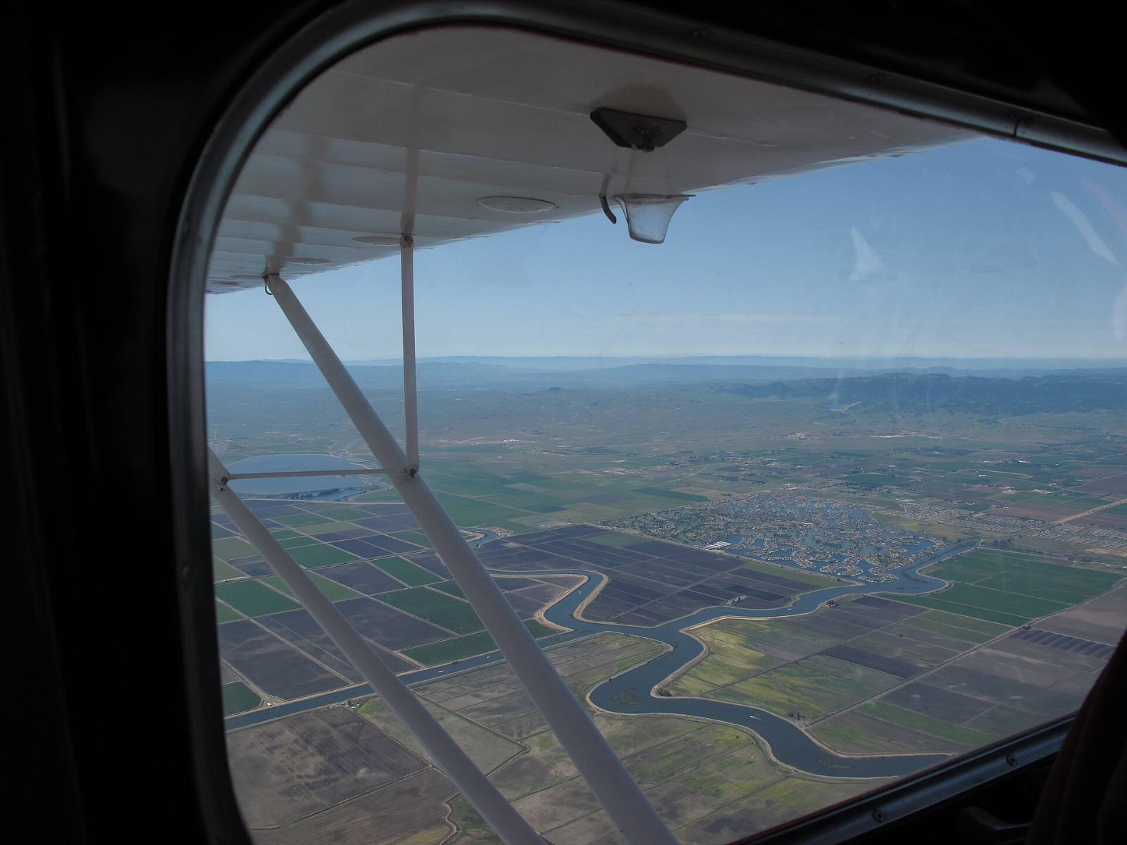
Photo above: Aerial view of Delta channels and farm fields with Discovery Bay, California in the distance, seen from a small plane, April 2012. mangtronix, CC BY-SA 2.0, via Wikimedia Commons.
.jpg)
Discovery Bay sits on the Byron Tract, a piece of Delta land ringed by 19.2 miles of levees that Reclamation District 800 maintains (Reclamation District 800 home page, checked September 25, 2026). Whether your home is in a FEMA flood zone, and whether a lender will require flood insurance, depends on FEMA’s map for your exact address, not on the town as a whole.
So check the address, read the RD 800 lines on the tax bill, and talk to a licensed insurance agent before you write an offer. Here’s how.
Who maintains the levees around Discovery Bay?
Reclamation District 800, a local public agency with its own elected board. The district covers 6,933 acres and calls itself one of 60 major islands or tracts that make up the Sacramento and San Joaquin Delta (RD 800 home page, checked September 25, 2026). Its August 2025 community presentation says it was formed in 1909 and serves 3,600 properties within the Byron Tract, with five full-time staff.
The Town of Discovery Bay doesn’t run the levees. Its page on RD 800 lists what the district does (Town of Discovery Bay, Reclamation District 800 page, checked September 25, 2026):
- provides flood protection for 3,600 properties
- inspects levees and supervises repairs
- evaluates levees against state and federal guidelines for a minimum of 100-year flood protection
- manages drainage and water circulation in the lakes and lagoons
- reviews construction on and around levees and slopes
That last one matters if you want a new dock, a patio near the water or anything on the slope. Ask RD 800 before you build. The district office is at 1540 Discovery Bay Boulevard, Suite A, (925) 634-2351.
How do I find the flood zone for a Discovery Bay address?
Use FEMA’s Flood Map Service Center at msc.fema.gov. Type the street address, open the map panel, and read the zone printed over the parcel. Save a screenshot with the date. We could not confirm the zones for Discovery Bay parcels ourselves, so we won’t guess at them here.
Two things to check on that map:
- The whole lot. A home on a lagoon has water on one side and a street on the other. Look at where the house sits, not just the pin.
- Newer changes. FEMA’s printed study for the county was revised March 21, 2017. Map changes can come later by letter, so ask FEMA or the County if the panel looks old.
For a sense of the water levels FEMA planned for, its Flood Insurance Study lists a 1-percent-annual-chance (100-year) stillwater elevation of 9.9 feet NAVD on the San Joaquin River at Byron Tract, and 10.3 feet for the 0.2-percent (500-year) flood (FEMA, Flood Insurance Study 06013CV001C, Contra Costa County, revised March 21, 2017, Table 7). Those are river levels, not the height of your floor.
Do I need flood insurance in Discovery Bay?
That’s a question for your lender and a licensed insurance agent, not us. Lenders set their own rules, and the FEMA zone on your address is the starting point for that conversation. FEMA’s FloodSmart site at floodsmart.gov explains how National Flood Insurance Program policies work and how to find an agent.
What we can tell you: RD 800’s own presentation lists “FEMA accreditation for 100-year flood protection” among its levee work (RD 800, community meeting presentation, August 28, 2025). Levees lower risk. They don’t erase it. Get a real quote early in escrow, before your contingency dates pass, so a surprise premium doesn’t sink your budget.
What do homeowners pay RD 800?
Homes inside RD 800 now carry two RD 800 assessments on the County property tax bill. Not every Discovery Bay address is inside the district, so check the tax bill.
- The original assessment. Property owners approved it in 1999, and RD 800 says the rate never went up. For fiscal year 2026-27 the board levied it at $145.06 per residential parcel on July 9, 2026 (RD 800, Notice of Assessment Calls, July 9, 2026 meeting; board minutes, July 9, 2026).
- The new Maintenance and Capital Assessment. Owners voted in a weighted ballot that closed October 23, 2025, and preliminary results showed 61.5% of the weighted vote in favor (RD 800, unofficial ballot results notice, checked September 25, 2026). On November 6, 2025 the board voted 5-0 to form the district and levy it starting in fiscal year 2026-27 (RD 800, board minutes, November 6, 2025). The July 9, 2026 notice says both assessments appear on 2026-27 County secured tax bills, with installments delinquent after December 10, 2026 and April 10, 2027.
How much is the new one? It depends on the parcel. RD 800 charges each home for up to four services: flood protection, bay access, water quality and drainage. Its August 2025 examples for single-family homes ranged from $203.53 a year for a sample home in the eastern bays to $660.17 a year for a sample home on Dolphin Cove in the western bays (RD 800, community meeting presentation, August 28, 2025). The assessment can rise each year by the lesser of inflation or 4%, and only by a board vote (RD 800, Assessment page, checked September 25, 2026).
For your exact number, enter the parcel number in RD 800’s assessment calculator (linked from rd800.org) and compare it with the current tax bill. If a line on the tax bill confuses you, ask a tax professional or the County Treasurer-Tax Collector.
What is RD 800 spending the new money on?
Levees, water and dredging. RD 800 says it took in about $2 million in fiscal year 2024-25, short of what its services cost. Its own documents give the yearly cost two ways: $3.1567 million on its Assessment page, and about $3.57 million in its 2025 assessment newsletter. Either way, the new assessment is set to raise $1.567 million a year starting in 2026-27 (RD 800, Assessment page and 2025 assessment newsletter, checked September 25, 2026). Ask RD 800 for the current figure. Its capital list from the same presentation included $5 million for levee repair and rehabilitation, $27.9 million for dredging the bay hallways and $3 million for Willow Lake water quality work.
Those are plans, not promises. Watch the board agendas at rd800.org if you want to see what actually gets built. The next meeting is October 8, 2026 at 8 am.
What should I ask before I buy a Discovery Bay home?
Five things. Ask for them all before your inspection contingency ends.
- The FEMA flood zone for the address, from msc.fema.gov, with the panel date.
- The current County tax bill, so you see both RD 800 lines.
- A flood insurance quote from a licensed agent, even if the lender doesn’t require one.
- The Natural Hazard Disclosure report, which covers flood hazard areas among other things.
- Any permits or RD 800 approvals for docks, walls or slope work behind the house. RD 800 also offers free rip rap rock to owners on deep water or Willow Lake for the slope behind their home (RD 800 home page, checked September 25, 2026).
If a disclosure raises a legal question, take it to a real estate attorney. Structural questions about a slope or a seawall go to a licensed engineer.
Questions people also ask
Is Discovery Bay below sea level?
We don’t have a sourced elevation for Discovery Bay homes, so we won’t guess. What is published: FEMA’s 2017 Flood Insurance Study puts the 100-year stillwater level of the San Joaquin River at Byron Tract at 9.9 feet NAVD. Reclamation District 800 maintains 19.2 miles of levees around the tract. Check any address on FEMA’s flood map.
Who do I call about the levee behind my house?
Reclamation District 800, at 1540 Discovery Bay Boulevard, Suite A, (925) 634-2351, per its website checked September 25, 2026. The Town of Discovery Bay’s page says RD 800 inspects levees, supervises repairs and reviews construction on and around levees and slopes. Ask RD 800 before you build a dock, wall or patio near the water.
How much is the RD 800 assessment?
It depends on the parcel. RD 800 levied the original 1999 assessment at $145.06 per residential parcel for 2026-27 (notice from its July 9, 2026 meeting), and its August 2025 presentation showed sample amounts for the new assessment from $203.53 to $660.17 a year. The new one starts in fiscal year 2026-27. Check your own parcel with RD 800’s calculator and the County tax bill.
Does Discovery Bay require flood insurance?
Your lender decides, based largely on the FEMA flood zone for your address. Look the address up at msc.fema.gov, then get a quote from a licensed insurance agent. FEMA’s FloodSmart site explains how flood policies work. Levees reduce risk but do not remove it, so a quote is worth getting even if it isn’t required.
Your next step
Send us the address you’re looking at. We’ll pull the FEMA map panel, the tax bill with both RD 800 lines, and recent sales on the same lagoon, so you and your insurance agent start from the same facts. Ask our team about a Discovery Bay home or call (510) 949-5525.
More on Discovery Bay: Is Discovery Bay a good place to live? · Selling a Discovery Bay home · What’s my home worth?
By Bill Davis, DRE #01880656, The Davis Team at eXp Realty, Discovery Bay, CA. Updated September 25, 2026.
Sources
- Reclamation District 800, home page and Assessment page: rd800.org (checked September 25, 2026)
- Reclamation District 800, “Proposed Maintenance and Capital Assessment,” community meeting presentation, August 28, 2025: rd800.org (checked September 25, 2026)
- Reclamation District 800, unofficial ballot results notice: rd800.org (checked September 25, 2026)
- Reclamation District 800, minutes of the November 6, 2025 and July 9, 2026 board meetings: rd800.org (checked September 25, 2026)
- Reclamation District 800, Notice of Assessment Calls for Operation and Maintenance and Capital Purposes, July 9, 2026 meeting: rd800.org (checked September 25, 2026)
- Town of Discovery Bay, Reclamation District 800 page: todb.ca.gov (checked September 25, 2026)
- FEMA, Flood Insurance Study 06013CV001C, Contra Costa County and Incorporated Areas, revised March 21, 2017, Table 7
- FEMA Flood Map Service Center: msc.fema.gov (checked September 25, 2026)
- FEMA FloodSmart: floodsmart.gov (checked September 25, 2026)