
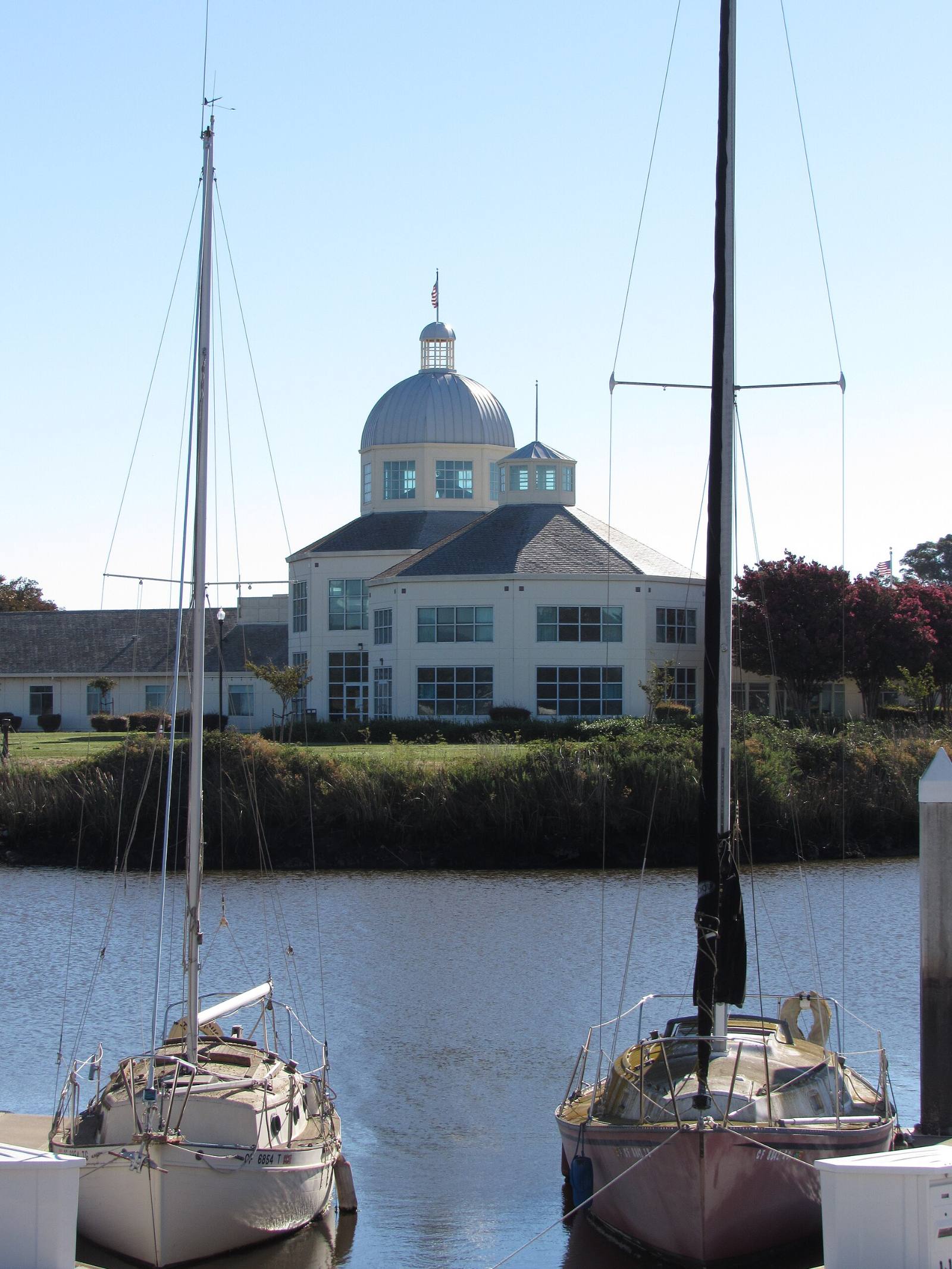
Photo above: Suisun City Hall seen across Suisun Slough between two boats in the harbor, Suisun City, California, August 2022. Kiddo27, CC BY-SA 4.0, via Wikimedia Commons.

It depends on the street. FEMA’s flood map in effect today puts part of Suisun City in the high risk zone, not most of it. When we sampled FEMA’s National Flood Hazard Layer inside city limits on September 25, 2026, roughly one fifth of the land fell in high risk Zones AE, AO or A, mostly the low ground south of Highway 12 around the waterfront and downtown. Most land north of Highway 12 mapped as Zone X, minimal risk (FEMA National Flood Hazard Layer, map panels effective 2009 and 2016, checked September 25, 2026).
An older planning study went further. A 2019 report for MTC and BCDC said most of Suisun City is within FEMA’s Special Flood Hazard Area, with a base flood elevation near 10 feet and ground mostly 5 to 10 feet (MTC and BCDC, Suisun City Focus Area report, 2019). Lenders go by the current FEMA map, not that report, and neither one is a survey of your lot. Before you offer on any Suisun City home, look up the exact address on FEMA’s current map and get a flood insurance quote. Here’s how, and what the sea level rise studies say about the streets near the marsh.
How do I check the flood zone for one address?
Go to FEMA’s Flood Map Service Center at msc.fema.gov, type the street address, and open the map for that spot. The zone label on the parcel is what lenders and insurers use. FloodSmart says you can also get it from your local floodplain administrator (FloodSmart, “What is my flood zone?”, checked September 25, 2026). The 2019 report names the city’s Public Works Director as Suisun City’s floodplain administrator.
Check the whole lot, not just the house. A backyard on a slough or a canal can map differently than the front door. If the seller has an elevation certificate, ask for it. It shows how high the lowest floor sits compared with the base flood elevation.
What do the zone letters mean?
A and V zones are the high risk ones. FEMA calls them the Special Flood Hazard Area: land that would flood in an event with a 1-percent chance of happening in any year, also called the base flood or 100-year flood. Shaded Zone X is moderate risk, between that line and the 0.2-percent (500-year) flood. Unshaded Zone X is minimal risk (FEMA, flood zones glossary, checked September 25, 2026).
A low risk label still leaves some chance of flooding. FloodSmart says 1 in 3 flood insurance claims come from low and moderate risk zones.
Where does Suisun City’s flood risk come from?
The bay, the rain and old marsh levees. The 2019 report says Suisun City’s flood sources include rainfall and coastal storm surge from San Francisco Bay. It also flags risk from embankment failures in the old levee system in Solano County’s marshlands, which was first built to reclaim marsh for grazing and crops (MTC and BCDC, 2019).
The town sits on the edge of the Suisun Marsh, which KQED describes as the largest brackish wetland in California (KQED, August 18, 2025, updated November 17, 2025). The same report says king tides already push brackish water into the local sewage treatment plant.
What do the sea level rise studies say for the streets near the marsh?
The low ground south of Highway 12 floods first in every scenario. The 2019 report tested rising “total water levels,” meaning sea level rise plus a storm tide, and named the areas that flood at each step (MTC and BCDC, 2019):
- 24 inches of total water level. The first level with flooding impacts. The report says this could happen briefly today with a 50-year storm tide. The marsh edge is overtopped, and the Cordelia Gateway, Historic Suisun and Downtown Core areas flood.
- 36 to 48 inches. The hardened shoreline along Suisun Channel is overtopped, with flooding in the Downtown Core, the train station, Historic Suisun, the Civic Center and the Harbor Village and Victorian Harbor neighborhoods.
- 52 inches (12 inches of sea level rise plus a 100-year storm tide). The first level that reaches Highway 12 and the Capitol Corridor line. The report expects it around mid-century.
KQED reported that state regulators expect nearly a foot of sea level rise by 2050 in their “most likely” scenario. A BCDC planning manager told KQED that with two feet of rise, flooding by 2050 could reach areas south of Highway 12, including a middle school, City Hall, downtown businesses and a rail line (KQED, August 18, 2025, updated November 17, 2025).
These are planning scenarios for the region, not a forecast for your street. To see the maps yourself, open BCDC’s Adapting to Rising Tides Bay Shoreline Flood Explorer at explorer.adaptingtorisingtides.org and zoom to Suisun City.
Will I have to buy flood insurance?
If the home is in a high risk zone and your mortgage is federally backed, yes. FloodSmart says flood insurance is mandatory for federally backed mortgages in high risk zones in communities that take part in the National Flood Insurance Program (FloodSmart, “What is my flood zone?”, checked September 25, 2026). Your lender sets the rules for your loan.
We’re not insurance agents and we don’t quote premiums. Ask a licensed insurance agent for a quote early in your inspection period, and read FEMA’s guides at floodsmart.gov. The NFIP’s help line is 877-336-2627 (same FloodSmart page). Put the premium into your monthly budget before you decide what you can offer.
Does the flood zone limit what I can build or remodel?
It can. The 2019 report says Suisun City’s floodplain ordinance requires new homes, and existing homes that are substantially improved, in FEMA flood zones to have the lowest floor, including any basement, at least half a foot above the base flood elevation (MTC and BCDC, 2019). If you plan a big addition or remodel, ask the city’s building permit staff what the rule means for that house before you buy.
What will the seller have to tell me?
California’s Natural Hazard Disclosure Statement asks whether the home is in a FEMA Special Flood Hazard Area (any Zone A or V) and whether it’s in an area of potential flooding on a dam failure inundation map (California Civil Code section 1103.2, checked September 25, 2026). Read it the day you get it. Questions about what the law requires go to a real estate attorney; questions about the map go to FEMA or the city.
What should I do before I write an offer?
- Look up the address at msc.fema.gov and write down the zone.
- Open the Bay Shoreline Flood Explorer and see how the street fares in the 24 and 52 inch scenarios.
- Ask the seller for any elevation certificate and current flood policy.
- Get an insurance quote before you remove contingencies.
Questions people also ask
Is Suisun City in a flood zone?
Part of it. On FEMA’s current map, checked September 25, 2026, roughly one fifth of the land inside city limits is in high risk Zones AE, AO or A, mostly south of Highway 12 near the waterfront and downtown. A 2019 MTC and BCDC study described most of the city as high risk, so read both with care. The answer for one home is the current map at msc.fema.gov for that exact address.
Will Suisun City be underwater from sea level rise?
Nobody can say what happens to one street. A BCDC planning manager told KQED that with two feet of sea level rise, flooding by 2050 could reach areas south of Highway 12, including City Hall and a middle school. State regulators’ most likely scenario is nearly a foot by 2050, per the same August 18, 2025 KQED report. Check the Bay Shoreline Flood Explorer for your street.
Do I need flood insurance in Suisun City?
If the home is in a high risk A or V zone and you have a federally backed mortgage, FloodSmart says flood insurance is mandatory, checked September 25, 2026. Outside those zones it is usually optional, but FloodSmart notes 1 in 3 claims come from low and moderate risk zones. A licensed insurance agent can quote the actual cost for the home.
Which Suisun City neighborhoods are most exposed to flooding?
The 2019 MTC and BCDC report names the Downtown Core, Historic Suisun, Cordelia Gateway, the Civic Center, and the Harbor Village and Victorian Harbor neighborhoods among the first areas to flood as water levels rise. It is a planning study, so check each address on FEMA’s current map.
Your next step
Send us the address. We’ll pull the FEMA zone, the flood items on the disclosure report, and the recent sales on that street, so you know the full picture before you offer. Talk to a Suisun City agent on our team or call (510) 949-5525.
More on Suisun City: Is Suisun City a good place to live? · Selling a home in Suisun City · What’s my home worth?
By Bill Davis, DRE #01880656, The Davis Team at eXp Realty, Suisun City, CA. Updated September 25, 2026.
Sources
- MTC, BCDC and Caltrans District 4, “Suisun City Focus Area, Example Application of the Adaptation Planning Process,” report by Silvestrum Climate Associates and AECOM, 2019 (posted March 2022): adaptingtorisingtides.org (downloaded and read September 25, 2026)
- BCDC, Adapting to Rising Tides Bay Shoreline Flood Explorer: explorer.adaptingtorisingtides.org (checked September 25, 2026)
- KQED, Adhiti Bandlamudi and Ezra David Romero, “As Flood Risk Grows, Suisun City Weighs Annexing California Forever Land,” August 18, 2025, updated November 17, 2025: kqed.org (checked September 25, 2026)
- FEMA, Flood Map Service Center: msc.fema.gov (checked September 25, 2026)
- FEMA, National Flood Hazard Layer (flood hazard zones and FIRM panels for Suisun City): hazards.fema.gov (checked September 25, 2026)
- FEMA, flood zones glossary: fema.gov/about/glossary/flood-zones (checked September 25, 2026)
- FloodSmart (National Flood Insurance Program), “What is my flood zone?”: floodsmart.gov (checked September 25, 2026)
- California Civil Code section 1103.2, Natural Hazard Disclosure Statement: leginfo.legislature.ca.gov (checked September 25, 2026)