
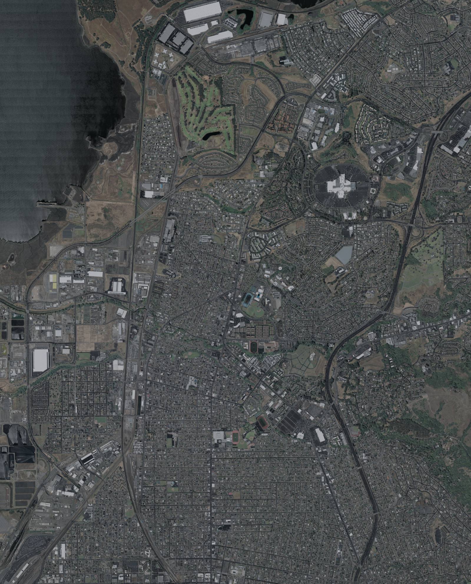
Photo above: USDA aerial image from May 2022 of San Pablo and north Richmond, with tree-lined creek corridors crossing the city toward San Pablo Bay. NOAA Office for Coastal Management / The USDA-FSA Aerial Photography Field offic, Public domain, via Wikimedia Commons.
It might be. FEMA’s high-risk flood areas in San Pablo follow San Pablo Creek and Wildcat Creek, plus Rheem Creek on the west side of the city, and lower-risk zones spread out past those. Look up the exact address on FEMA’s flood map, then ask the City’s Engineering Division to confirm whether the house itself, not just the lot, falls inside the line.
Whether you can see a creek from the yard does not settle it. The map does. Here is how to check, who to call, and what it means for your loan and insurance.
Where are San Pablo’s flood zones?
Mostly along the three creeks. The City’s Flood Information page says FEMA’s 100-year floodplains, which FEMA calls the Special Flood Hazard Area, sit “mainly along San Pablo and Widcat Creeks, and along Rheem Creek at the west side of the City.” The 500-year floodplain reaches farther out from those edges (City of San Pablo, Flood Information page, checked September 24, 2026; the City’s spelling of Wildcat).
The high-risk zones in the city carry three labels:
- Zone A: high risk, no detailed flood elevation shown.
- Zone AE: high risk, with a base flood elevation on the map.
- Zone AO: high risk from shallow flooding, usually with a depth.
The City also says the chance of a flood in the Special Flood Hazard Area is at least 1 in 4 over a 30-year mortgage.
How do I check one address?
Two steps. Both are free.
- FEMA’s Flood Map Service Center at msc.fema.gov/portal. Type the address and open the interactive map. Note the zone letter, the panel number and the map’s effective date. The City says FEMA’s last map release for San Pablo came out in 2015, and warns that the FEMA site “may not have been updated” (City of San Pablo, Flood Information page, checked September 24, 2026).
- City of San Pablo Engineering at (510) 215-3060. The City provides FEMA maps and flood zone determinations for properties inside city limits on request, and keeps a more detailed map at City Hall, 1000 Gateway Avenue (City of San Pablo, Flood Safety brochure and Flood Information page, checked September 24, 2026).
Why the second call matters: the City says if only part of your lot is in Zone A and the buildings are not, you may not be required to carry flood insurance. The map line and the house footprint are two different questions. Ask Engineering for the answer about the structure.
Who takes care of Wildcat and San Pablo creeks?
The lower channels belong to the county. According to a Contra Costa County flood profile from the Adapting to Rising Tides project, the U.S. Army Corps of Engineers built a flood control project on Wildcat and San Pablo creeks from 1987 to 1992, for development downstream of the Union Pacific Railroad. The Contra Costa County Flood Control and Water Conservation District owns and maintains those channels (Adapting to Rising Tides, Wildcat and San Pablo Creeks asset profile, December 2015).
Three things from that same profile a buyer should know:
- It is a 2015 document. It is the newest public write-up we could reach. Ask the county flood control district what has changed since.
- Upstream is different. A footnote says significant flooding happens upstream of the Corps project, and efforts to start a second phase had not succeeded as of 2015.
- Money is tight. The district said it received only 8% of the funding needed to maintain the two creeks, because of limits tied to Propositions 13 and 218.
The county also posts a live stream gauge for Wildcat Creek at the Vale Road bridge on its flood control site, ccflood.us, and the City links to it (Contra Costa County Flood Control, Stream Gauge Plots page, checked September 24, 2026). In a big storm, that plot shows you how high the creek is running.
Has San Pablo flooded before?
Yes. The City’s General Plan 2035 Safety Element, adopted July 7, 2025, says severe rain has caused flash floods in the past, including on University Avenue next to Wildcat Creek, and includes a policy to cooperate on flood control projects on Wildcat and San Pablo creeks (City of San Pablo, General Plan 2035, checked September 24, 2026). The City also notes that about 90% of the county’s rain falls from November to April, and flooding usually hits in those months.
Want a second, model-based view? Redfin’s San Pablo page shows First Street’s Flood Factor as “Moderate,” with 21% of properties at risk of severe flooding over the next 30 years (Redfin, San Pablo housing market page, climate section, checked September 24, 2026). That is a private model, not a FEMA zone, and it does not decide insurance requirements.
Can I use the National Hydrography Dataset to check?
Only to see where water runs, not to see a flood zone. The USGS describes the National Hydrography Dataset as the map of the country’s drainage network: rivers, streams, canals, lakes and similar features. USGS retired it on October 1, 2023; the data is still available but no longer maintained, and new work goes into its 3D Hydrography Program (USGS, National Hydrography Dataset page, checked September 24, 2026).
Here is how it helps. Open The National Map viewer at apps.nationalmap.gov/viewer, turn on the hydrography layer, and see whether a mapped creek or channel runs near the back fence. That is a good reason to ask more questions. It is not a zone, and it will not tell you whether a lender requires insurance.
Don’t mix it up with the other “NHD.” In a California sale, NHD usually means the Natural Hazard Disclosure statement, the seller’s form that says whether the property is in a Special Flood Hazard Area, among other things (California Civil Code 1103.2, checked September 24, 2026). Read that form closely before you remove contingencies.
Will I have to buy flood insurance?
If the house is in the Special Flood Hazard Area and a federally regulated lender holds the mortgage, yes. The City says purchase is mandatory in that case, and outside the high-risk zone it is optional (City of San Pablo, Flood Information page, checked September 24, 2026). From the City’s flood brochure:
- A standard homeowners policy does not cover flooding.
- National Flood Insurance Program policies have a 30-day waiting period before coverage starts.
- More than 20% of flood insurance claims come from properties outside the Special Flood Hazard Area.
- San Pablo joined FEMA’s Community Rating System in October 2013. The brochure lists a Class 8 rating, worth 10% off premiums inside the high-risk zone and 5% outside.
We are not insurance agents, and premiums depend on the building. For a quote, what a policy covers and whether that discount still applies, talk to a licensed insurance agent. FloodSmart.gov, FEMA’s flood insurance site, is the official starting point.
What if the map puts my house in the wrong zone?
You can ask FEMA to change it. The City’s Flood Information page links to FEMA’s online process for a Letter of Map Change, the formal request to change a flood zone designation. Expect to need survey or elevation information for the building. Call City Engineering at (510) 215-3060 before you start; they can tell you what the local map shows.
What should I plan for if I buy a creekside home?
A little more upkeep and a little more paperwork. The City’s brochure says:
- Creek care on private land is the owner’s job. Keeping the channel on your property clear of fallen trees, debris and trash is your responsibility. City crews clean channels on City property and rights-of-way. Report problems to the Public Works Corporation Yard at (510) 215-3070.
- Big remodels trigger the flood rules. If improvements or repairs cost 50% or more of the building’s market value, the building must meet the standards for new construction, which can mean elevating it above the base flood elevation. Check with Building Services at (510) 215-3030 before you design anything.
- Sandbags are free for residents in winter at the Corporation Yard, 1515 Folsom Avenue.
Questions people also ask
Is San Pablo, CA in a flood zone?
Parts of it are. The City says FEMA’s 100-year floodplains run mainly along San Pablo and Wildcat creeks, plus Rheem Creek on the west side, with 500-year zones beyond them. High-risk areas are labeled Zone A, AE or AO. Check your address on FEMA’s Flood Map Service Center and confirm with City Engineering at (510) 215-3060.
Who can tell me if my San Pablo house is in the flood zone?
The City of San Pablo’s Engineering Division, at (510) 215-3060. It provides FEMA flood maps and flood zone determinations for properties inside city limits, and it can say whether the building itself sits in the zone when only part of the lot does. You can also view a more detailed map at City Hall, 1000 Gateway Avenue.
Do I need flood insurance near Wildcat Creek?
If the house is inside the Special Flood Hazard Area and a federally regulated lender holds your loan, flood insurance is required, per the City. Outside that zone it is optional, but the City’s brochure notes more than 20% of flood claims come from outside it. Policies usually take 30 days to start. Get a quote from a licensed insurance agent.
Does the National Hydrography Dataset show flood zones?
No. The USGS National Hydrography Dataset maps streams, rivers, canals and lakes, and USGS stopped maintaining it on October 1, 2023. It shows where a creek runs, which is useful context, but it does not show FEMA flood zones or insurance requirements. For zones, use FEMA’s Flood Map Service Center and ask City Engineering.
Your next step
Looking at a home near one of the creeks? Send us the address. We’ll pull the FEMA panel, the Natural Hazard Disclosure and recent sales on that street, and point you to the right City desk and a licensed insurance agent before your contingencies run out. Ask a San Pablo agent on our team or call (510) 949-5525.
More on San Pablo: Living in San Pablo, CA · What it costs to sell in San Pablo · Search homes for sale · What’s my home worth?
By Bill Davis, DRE #01880656, The Davis Team at eXp Realty, San Pablo, CA. Updated September 24, 2026.
Sources
- City of San Pablo, Flood Information: sanpabloca.gov/1163 (checked September 24, 2026)
- City of San Pablo, Flood Safety brochure for property owners: sanpabloca.gov/DocumentCenter/View/13125 (checked September 24, 2026)
- City of San Pablo, General Plan 2035, Safety Element, adopted July 7, 2025: sanpabloca.gov/2804 (checked September 24, 2026)
- FEMA Flood Map Service Center: msc.fema.gov/portal (checked September 24, 2026)
- FEMA, FloodSmart: floodsmart.gov (checked September 24, 2026)
- Adapting to Rising Tides (Contra Costa County project), Wildcat and San Pablo Creeks asset profile sheet, December 2015: adaptingtorisingtides.org
- Contra Costa County Flood Control, Stream Gauge Plots, Wildcat Creek at Vale Road Bridge: ccflood.us/strmgauges.html (checked September 24, 2026)
- U.S. Geological Survey, National Hydrography Dataset: usgs.gov/national-hydrography/national-hydrography-dataset (checked September 24, 2026)
- U.S. Geological Survey, The National Map viewer: apps.nationalmap.gov/viewer (checked September 24, 2026)
- Redfin, San Pablo housing market page, climate section (First Street Flood Factor), checked September 24, 2026: redfin.com/city/17500/CA/San-Pablo/housing-market
- California Civil Code 1103.2, Natural Hazard Disclosure Statement: leginfo.legislature.ca.gov (checked September 24, 2026)