
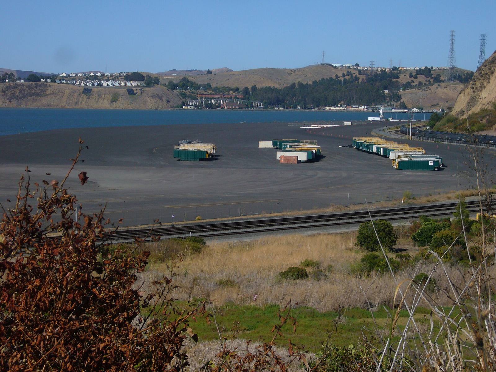
Photo above: Low shoreline flats with a rail line along San Pablo Bay at the edge of Rodeo, California, with hillside homes behind, 2007. Jo Guldi, CC BY 2.0, via Wikimedia Commons.

Maybe, and you can find out for one address in about ten minutes. Type the street address into FEMA’s Flood Map Service Center, and if you want it in writing, ask Contra Costa County Public Works for a flood zone determination, because Rodeo has no city government and the county runs its floodplain program.
Rodeo sits between the hills and San Pablo Bay, with Rodeo Creek running through the middle of it. So don’t guess from the street name. Check the parcel.
Where do I look up the official flood zone?
Start at FEMA. The Flood Map Service Center at msc.fema.gov is FEMA’s official public source for the flood maps used by the National Flood Insurance Program (FEMA, Flood Map Service Center, checked September 24, 2026). Enter the full address, open the map, and find the zone label on the lot.
What the label means, in plain English (FEMA, flood zones glossary, checked September 24, 2026):
- Zones that start with A or V are Special Flood Hazard Areas. That is the area FEMA expects a flood with a 1% chance in any given year to cover, often called the 100-year flood.
- Shaded Zone X (or Zone B) is moderate risk, between the 100-year and the 500-year flood lines.
- Unshaded Zone X (or Zone C) is lower risk, above the 500-year flood line.
Lower risk still means some risk. Water doesn’t read maps.
Who in Rodeo can confirm the zone for me?
Contra Costa County Public Works. The county’s Floodplain Management Program covers unincorporated areas only, and Rodeo is one of them (Contra Costa County, FEMA Floodplain Management Program page, checked September 24, 2026).
Here is what the county says it will do:
- A written determination. Staff use the Assessor’s parcel map, county base maps and FEMA data. The fee is $100 per parcel. If a site visit is needed, add $400 plus time and materials.
- What you get back. The FEMA map designation, the community and panel number, the map’s effective date, the base flood elevation if the map has one, and the average depth of flooding.
- Who to call. The Floodplain Management team is reached through the Public Works main line, (925) 313-2000. Have the address or parcel number ready.
Same source for all three, checked September 24, 2026.
Does a flood zone change what I can build?
Yes, if the home is in a Special Flood Hazard Area. Adding on or rebuilding there takes a Floodplain Permit from Public Works, and new or substantially improved homes need an Elevation Certificate. The county’s floodplain ordinance also requires the lowest floor of new or substantially improved structures to sit one to two feet above the base flood elevation (Contra Costa County, FEMA Floodplain Management Program page, checked September 24, 2026).
Planning an addition or an ADU? Ask the county about the zone before you pay for drawings. For anything legal about the permit, talk to a land use attorney.
What if I think the map is wrong?
You can ask FEMA to take a second look. A Letter of Map Amendment or Letter of Map Revision request goes straight to FEMA from the owner or the owner’s representative, and the county keeps Elevation Certificates on file for new and substantially improved homes in the flood area (Contra Costa County, FEMA Floodplain Management Program page, checked September 24, 2026). A licensed land surveyor or civil engineer usually prepares the elevation data.
How much of Rodeo is at flood risk?
It depends on whose model you read. First Street, a private risk model shown on Redfin, rates Rodeo’s Flood Factor as “Major” and says 18% of properties in Rodeo are at risk of severe flooding over the next 30 years (Redfin, Rodeo housing market page, climate section, checked September 24, 2026).
That is not a FEMA zone, and it doesn’t tell you about one house. Use it as a reason to check, not as an answer.
What is the county doing on Rodeo Creek right now?
Fixing the creek bank. The county is rebuilding the west bank of Rodeo Creek at two spots, about 150 feet north of Fourth Street and about 100 feet north of Seventh Street, near Vaqueros Avenue. Construction started July 6, 2026, with completion estimated for October 15, 2026. The estimated contract cost is $694,000, paid 100% from Flood Control Zone funds (Contra Costa County Public Works, Rodeo Creek Bank Erosion Repair project page, checked September 24, 2026).
This is erosion repair. It does not change anyone’s FEMA zone. If you’re looking at a home along the creek, walk the bank and look at it yourself.
What about sea level rise along the Rodeo shoreline?
FEMA’s maps show today’s risk. For the future, look at two free planning maps from official sources:
- BCDC’s Adapting to Rising Tides Bay Shoreline Flood Explorer at explorer.adaptingtorisingtides.org. The San Francisco Bay Conservation and Development Commission built it to show shoreline flood risk from sea level rise and storms. BCDC says its mapping is complete for all nine Bay Area counties (Adapting to Rising Tides, Bay Area Sea Level Rise and Shoreline Analysis Maps page, checked September 24, 2026).
- Our Coast, Our Future at ourcoastourfuture.org, a partnership of the U.S. Geological Survey and Point Blue Conservation Science. It maps sea level rise and storm scenarios, and it covers San Francisco Bay (Our Coast, Our Future, About page, checked September 24, 2026).
Both are planning tools, not insurance maps. Look at the scenarios for the block you care about, not the whole bay.
What will the Natural Hazard Disclosure say?
It tells you two things about water. Under California Civil Code 1103.2, the seller’s Natural Hazard Disclosure says whether the property is in a FEMA Special Flood Hazard Area (any Zone A or V) and whether it is in an area of potential flooding on a dam failure inundation map (California Legislative Information, Civil Code 1103.2, checked September 24, 2026). The same form covers fire and earthquake areas too.
The statute itself says these disclosures are not definitive indicators of whether a disaster will affect the property. Read the report, then check the map yourself. If a line in it worries you, ask your agent to walk you through it, and ask a real estate attorney about anything legal.
Will I need flood insurance?
Ask a licensed insurance professional. We don’t give insurance advice. Here is what the official sources say:
- Lenders. The county says flood insurance is mandatory in Special Flood Hazard Areas for federally backed mortgages, and lenders may require it elsewhere (Contra Costa County, FEMA Floodplain Management Program page, checked September 24, 2026).
- Timing. FEMA’s FloodSmart site says a new flood policy usually starts 30 days after purchase, with no wait when you buy it while getting a mortgage (FloodSmart, Buy a Policy page, checked September 24, 2026). It also notes most homeowners policies leave out flood damage.
- County rating. The county says it holds a Class 6 rating in FEMA’s Community Rating System, which it says saves National Flood Insurance Program policyholders 20% in high-risk areas and 10% in lower-risk areas (Contra Costa County, FEMA Floodplain Management Program page, checked September 24, 2026). Ask your insurance professional how that applies to a quote.
Get a real quote on the exact address during your inspection period. A surprise premium is easier to deal with before you remove contingencies than after you close.
Questions people also ask
Is Rodeo, CA in a flood zone?
Parts of it may be, and the answer is parcel by parcel. Enter the address at FEMA’s Flood Map Service Center, msc.fema.gov, and read the zone on that lot. For a written answer, Contra Costa County Public Works gives flood zone determinations for unincorporated areas like Rodeo for $100 per parcel, per its floodplain page, checked September 24, 2026.
Who handles flood zones in Rodeo if there is no city?
Contra Costa County. Rodeo is unincorporated, and the county’s Floodplain Management Program covers unincorporated areas only. Public Works gives written flood zone determinations, issues Floodplain Permits and keeps Elevation Certificates. Reach the Floodplain Management team through the Public Works main line, (925) 313-2000, per the county floodplain page, checked September 24, 2026.
Does Zone X mean I don’t need flood insurance?
Not always. FEMA treats shaded Zone X as moderate risk and unshaded Zone X as lower risk, and a lender can still require coverage outside the high-risk zones, according to the county’s floodplain page, checked September 24, 2026. Whether you should buy a policy is a question for a licensed insurance professional who can quote the exact address.
Where can I see sea level rise maps for Rodeo?
Two free official tools cover the Rodeo shoreline. BCDC’s Adapting to Rising Tides Bay Shoreline Flood Explorer maps shoreline flooding from sea level rise and storms for all nine Bay Area counties. Our Coast, Our Future, from USGS and Point Blue Conservation Science, maps sea level rise and storm scenarios for San Francisco Bay. Both were checked September 24, 2026.
Your next step
Send us the Rodeo address. We’ll pull the FEMA map panel, the disclosure report and nearby sales, and go through them with you before you commit. Ask a Rodeo agent on our team or call (510) 949-5525.
More on Rodeo: Living in Rodeo, CA · Should I avoid homes near the Rodeo refinery? · What’s my home worth?
By Bill Davis, DRE #01880656, The Davis Team at eXp Realty, Rodeo, CA. Updated September 24, 2026.
Sources
- FEMA Flood Map Service Center: msc.fema.gov (checked September 24, 2026)
- FEMA, flood zones glossary: fema.gov/about/glossary/flood-zones (checked September 24, 2026)
- Contra Costa County Public Works, FEMA Floodplain Management Program: contracosta.ca.gov/332 (checked September 24, 2026)
- Contra Costa County Public Works, Rodeo Creek Bank Erosion Repair, Project No. 7531-6D9NO4: contracosta.ca.gov/10404 (checked September 24, 2026)
- Redfin, Rodeo housing market page, climate section (First Street Flood Factor): redfin.com/city/25362/CA/Rodeo/housing-market (checked September 24, 2026)
- San Francisco Bay Conservation and Development Commission, Adapting to Rising Tides: adaptingtorisingtides.org and explorer.adaptingtorisingtides.org (checked September 24, 2026)
- Our Coast, Our Future (USGS and Point Blue Conservation Science): ourcoastourfuture.org (checked September 24, 2026)
- California Civil Code 1103.2, Natural Hazard Disclosure Statement: leginfo.legislature.ca.gov (checked September 24, 2026)
- FEMA, FloodSmart, Buy a Policy: floodsmart.gov/get-insured/buy-a-policy (checked September 24, 2026)