
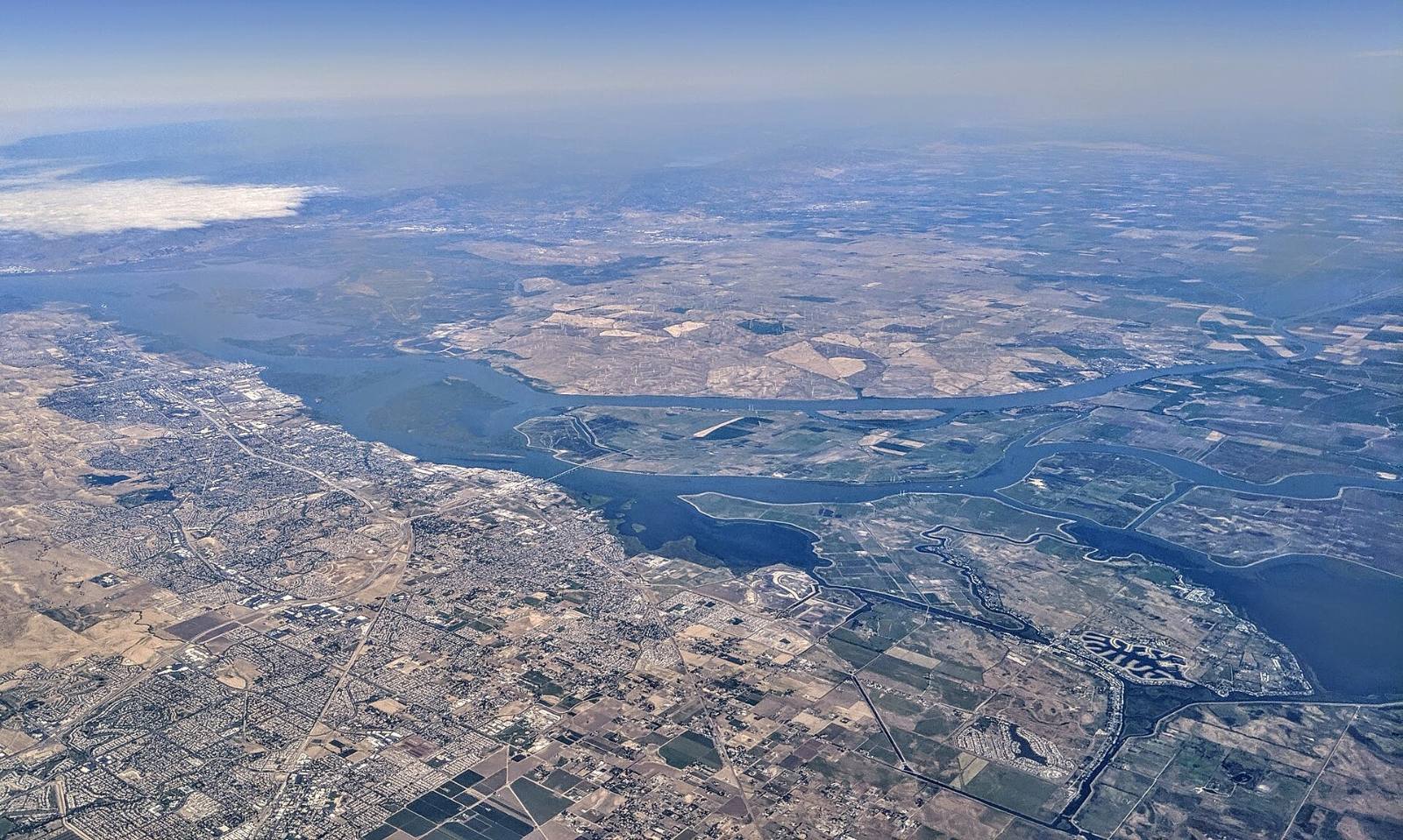
Photo above: Aerial view of the San Joaquin and Sacramento river confluence and the Delta at Antioch, May 2019. Dicklyon, CC BY-SA 4.0, via Wikimedia Commons.

Probably not, but check the exact address. The City of Antioch’s Housing Element says FEMA maps most of Antioch as having minimal or no flooding, and that the flood-prone areas sit mainly along the San Joaquin River and the creeks that feed it (City of Antioch, Housing Element 2023-2031, Constraints chapter, checked September 25, 2026).
“Most of the city” isn’t your house, though. It takes about five minutes on FEMA’s free map to know for sure. Here’s how, and which Antioch spots FEMA itself calls out.
How do I look up an Antioch address?
Use FEMA’s Flood Map Service Center at msc.fema.gov. Type the street address, open the map for that spot, and read the zone printed on the parcel. FEMA’s FloodSmart site says you can find your zone there or by contacting your local floodplain administrator (FloodSmart, “What is my flood zone?”, checked September 25, 2026).
Two tips. First, look at the lot, not just the house. A backyard that touches a creek channel can sit in a different zone than the front door. Second, check whether a newer map change covers the spot. FEMA’s study warns that parts of it can be revised by a Letter of Map Revision without a new printed study, so users should check with local officials for the current version (FEMA, Flood Insurance Study 06013CV001C, revised March 21, 2017).
Antioch’s community number in FEMA’s program is 060026 (same FEMA study). You may see that number on a flood report.
What do the flood zones mean?
Letters starting with A or V are the high-risk zones. FEMA calls them Special Flood Hazard Areas: land expected to flood in an event with a 1-percent chance of happening in any year. Zone X comes in two kinds. Shaded X, or Zone B on older maps, is moderate risk, between the 1-percent and 0.2-percent flood lines. Unshaded X, or Zone C, is minimal risk (FEMA, flood zones glossary, checked September 25, 2026).
“Minimal” doesn’t mean never. FloodSmart says one in three flood insurance claims comes from low and moderate risk zones (FloodSmart, “What is my flood zone?”, checked September 25, 2026).
Which parts of Antioch does FEMA say flood?
FEMA’s Flood Insurance Study for Contra Costa County has a section on Antioch. It says shallow flooding “occurs often in Antioch at a few locations” and names them (FEMA, Flood Insurance Study 06013CV001C, revised March 21, 2017):
- West Antioch Creek, north of the Union Pacific Railroad and north of West 10th Street. These areas flood when the culverts can’t carry the water.
- Contra Loma Boulevard and L Street. Water backs up behind undersized culverts on West Antioch Creek at both crossings. At the railroad, the creek’s culvert pushes water along a low strip beside the tracks toward L Street.
- Low ground next to Lake Alhambra, on East Antioch Creek. The study says the North Lake Drive bridge at the lake’s outlet, combined with high tides, can keep water from draining out.
- Markley Creek at the railroad. An undersized culvert lets the 1-percent flood top the railroad embankment, though the study says most of the flow stays in the channel upstream.
The same study says there are no stream gages in or around Antioch, so there are no records of past flood events. That’s a gap worth knowing. The map is a model, not a history.
Is anything protecting those areas?
Some, not much. The study lists improved creek channels on Markley Creek, between Highway 4 and the railroad, and on West Antioch Creek near Putnam Road and from Highway 4 to the railroad. It says they give the homes beside them only limited protection in a 1-percent flood. It also says the levees along West Branch East Antioch Creek weren’t built for flood control (same FEMA study).
Who maintains the pipes and channels? The city’s Housing Element says storm drain lines empty into channels owned and maintained by both the City of Antioch and the Contra Costa County Flood Control and Water Conservation District (City of Antioch, Housing Element 2023-2031, Constraints chapter).
Will I have to buy flood insurance?
It depends on the zone and the loan. FloodSmart says that in communities in the National Flood Insurance Program, flood insurance is mandatory for federally backed mortgages on buildings in high-risk zones (FloodSmart, “What is my flood zone?”, checked September 25, 2026). Your lender decides what your loan requires.
Outside those zones it’s usually your choice. We’re not insurance agents and we don’t give insurance advice. Ask a licensed insurance agent for a quote early in escrow, and read FEMA’s plain-English guides at floodsmart.gov.
What does a seller have to tell me?
California requires it on a form. The Natural Hazard Disclosure Statement asks whether the home lies in a FEMA Special Flood Hazard Area (any Zone A or V) and whether it sits in an area of potential flooding shown on a dam failure inundation map (California Civil Code sections 1103 and 1103.2, checked September 25, 2026).
Read that report the day you get it, not the day before you close. If something on it worries you, questions about what the law requires go to a real estate attorney, and questions about the land itself go to the agency that drew the map.
What should I do before I write an offer?
Three steps, in this order:
- Look up the address on FEMA’s map and write down the zone.
- If it’s near one of the spots above, or in any A zone, get an insurance quote before you remove contingencies.
- Walk the street after a big storm if you can. Look at the gutters, the creek bank and the low corner of the yard.
Questions people also ask
How do I find the flood zone for an Antioch address?
Go to FEMA’s Flood Map Service Center at msc.fema.gov and search the street address. The map shows the zone for that parcel, such as AE, shaded X or unshaded X. FloodSmart, checked September 25, 2026, says you can also contact your local floodplain administrator. Check the whole lot, since a yard near a creek can map differently than the house.
Is the Antioch waterfront in a flood zone?
The City of Antioch’s Housing Element says the city’s flood-prone areas are mainly along the San Joaquin River and its tributary creeks, and that FEMA maps most of Antioch as minimal or no flooding. Whether a specific home near the river is in a high-risk zone depends on its exact spot, so look up the address on FEMA’s map before you offer.
Does Lake Alhambra flood?
FEMA’s Flood Insurance Study for Contra Costa County, revised March 21, 2017, lists flooding of low-lying areas next to Lake Alhambra on East Antioch Creek. It says the North Lake Drive bridge at the lake’s outlet, combined with high tides, can keep water from draining. Check the FEMA map for the exact address and ask a licensed insurance agent about coverage.
Do I need flood insurance in Antioch?
If the home is in a high-risk zone and you have a federally backed mortgage, FloodSmart says flood insurance is mandatory, checked September 25, 2026. Outside those zones it’s usually optional, but FloodSmart notes one in three claims comes from low and moderate risk areas. Your lender sets the loan’s rules, and a licensed insurance agent can quote the cost.
Your next step
Send us the address. We’ll pull the FEMA zone, the flood items on the disclosure report and recent sales on that street, so you know what you’re looking at before you offer. Talk to an Antioch agent on our team or call (510) 949-5525.
More on Antioch: Living in Antioch, CA · Selling a home in Antioch · What’s my home worth?
By Bill Davis, DRE #01880656, The Davis Team at eXp Realty, Antioch, CA. Updated September 25, 2026.
Sources
- FEMA, Flood Insurance Study, Contra Costa County, California and Incorporated Areas, Volume 1, number 06013CV001C, revised March 21, 2017: map1.msc.fema.gov (downloaded and read September 25, 2026)
- FEMA, Flood Map Service Center: msc.fema.gov (checked September 25, 2026)
- FEMA, Flood zones glossary: fema.gov/about/glossary/flood-zones (checked September 25, 2026)
- FloodSmart (National Flood Insurance Program), “What is my flood zone?”: floodsmart.gov (checked September 25, 2026)
- City of Antioch, Housing Element 2023-2031, Final Draft, Chapter 4, Constraints: antiochca.gov/DocumentCenter/View/747 (checked September 25, 2026)
- California Civil Code sections 1103 and 1103.2, Natural Hazard Disclosure Statement: leginfo.legislature.ca.gov (checked September 25, 2026)