
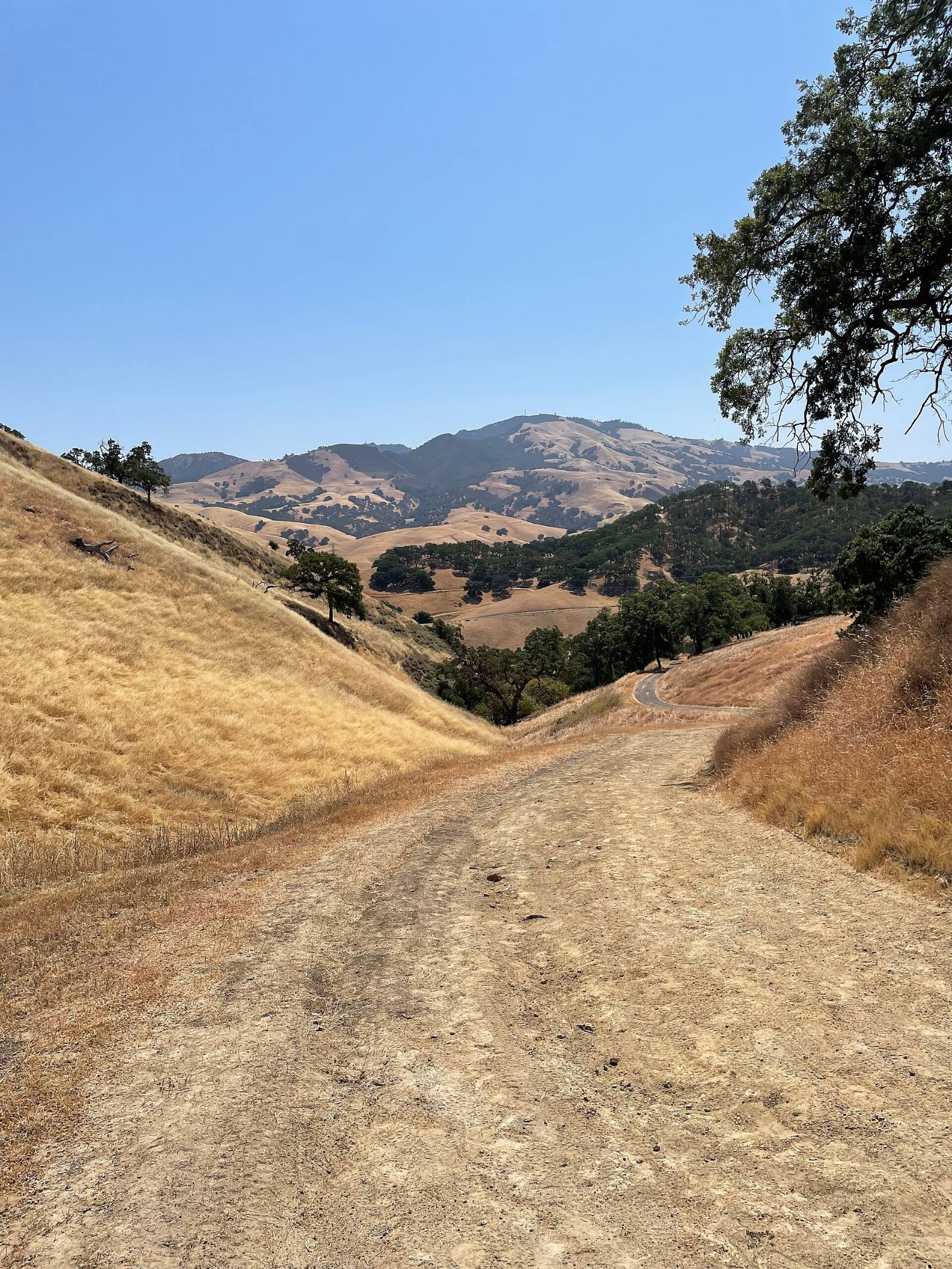
Photo above: Dry grass hills and a fire road in Shell Ridge Open Space, Walnut Creek, California, with Mount Diablo behind, June 2025. 12345aaaaa, Public domain, via Wikimedia Commons.

Maybe, if it sits near the hills. The State Fire Marshal’s map for Walnut Creek, dated February 24, 2025, rates parts of the city high or moderate, mostly where neighborhoods meet open space on the eastern hills and in the southwest toward Moraga. Much of the flatter middle of town is unzoned. Con Fire says the map took effect July 10, 2025, and you can look up any single address yourself in a couple of minutes.
Here’s how to read the map, who adopted it, and what it means for disclosures and insurance.
Which parts of Walnut Creek are in a fire hazard zone?
The edges, mostly. On the Local Responsibility Area map for the City of Walnut Creek, land inside city limits is shaded only high or moderate. There is no very high shading inside the city on that map (CAL FIRE Office of the State Fire Marshal, “Local Responsibility Area Fire Hazard Severity Zones, City of Walnut Creek,” February 24, 2025, posted by Con Fire, checked September 24, 2026).
Reading the map by direction:
- East side. Large high zones run along the eastern hills, with moderate bands between them and the streets below.
- Southwest. A long high zone, edged in moderate, sits in the southwestern part of the city toward Moraga.
- West. A smaller moderate area shows up on the western edge.
- The middle. Most of central Walnut Creek, including the I-680 corridor, is shaded as unzoned.
The hills just outside city limits are a different map. Those are State Responsibility Area lands, zoned by CAL FIRE under maps that took effect April 1, 2024 (same map legend; OSFM, Fire Hazard Severity Zones page, checked September 24, 2026). If a house has an unincorporated address near Walnut Creek, check which map covers it.
A citywide summary only gets you so far. The only answer that counts is the one for your parcel.
How do I look up my address?
Use the official viewer, then save a copy. Three ways, all free:
- Con Fire’s page. The Contra Costa County Fire Protection District’s Local Responsibility Area Maps page links the new map viewer and CAL FIRE’s Fire Hazard Severity Zone viewer. Type the address and zoom to the lot.
- The city PDF. The same page posts an “LRA Walnut Creek Map (PDF).” Good for seeing the whole city at once.
- CAL FIRE’s statewide viewer. Linked from the State Fire Marshal’s Fire Hazard Severity Zones page at osfm.fire.ca.gov. It also shows the State Responsibility Area zones.
Questions about how the map was drawn go to CAL FIRE at [email protected] or (916) 633-7655 (OSFM page). Questions about local fire rules go to Con Fire at (925) 941-3300.
Who adopted the map, and when did it take effect?
Con Fire did. The Contra Costa County Fire Protection District serves Walnut Creek, and its Local Responsibility Area Maps page posts the Walnut Creek map with the other cities it covers (Con Fire, checked September 24, 2026). The order of events:
- February 24, 2025. The State Fire Marshal issued the Walnut Creek map, part of Phase 2 of the statewide rollout (OSFM page; map date).
- May 20, 2025. The Board of Supervisors, acting as Con Fire’s board, introduced Ordinance No. 2025-09 to designate the zones and set June 10, 2025 for adoption (Contra Costa County, Legistar file 25-1931).
- July 1, 2025. Con Fire issued a notice that the district had adopted maps consistent with the State Fire Marshal’s recommendation, effective July 10, 2025 (Con Fire notice, received by the County Clerk-Recorder July 3, 2025).
- July 10, 2025. The new zones took effect (Con Fire, Local Responsibility Area Maps page, checked September 24, 2026).
Could it have come out lower? No. The notice cites state law, Government Code 51179, which says a local agency may not lower a zone the State Fire Marshal identified.
Does a high zone mean the house is likely to burn?
The map can’t tell you that. It measures hazard, not risk. The State Fire Marshal explains that hazard looks at physical conditions like vegetation, terrain, embers and fire weather over a 30 to 50 year period, and leaves out home hardening, recent fires and fuel reduction. Risk is the damage a fire could do once those things are counted (OSFM, Fire Hazard Severity Zones page, checked September 24, 2026).
So the zone alone doesn’t describe a specific house. Walk the lot.
What does the city do in the open space behind these homes?
The city says it works with CAL FIRE and Con Fire on fire prevention in its parks and open space. Its Fire Preparedness page lists the work (City of Walnut Creek, Open Space, Fire Preparedness page, checked September 24, 2026):
- Grazing. Rotational cattle and goat grazing to cut down vegetation.
- Disked fuel breaks. About 18 miles along ridge lines, fire roads and property lines, where possible.
- Hand-trimmed fuel breaks. More than 10 miles along open space property lines.
- Tree work. Removing hazardous trees and fixing other fire hazards.
Open space areas can also close when the National Weather Service issues a Red Flag Warning and regional fires would stretch response. Signs go up at trailheads. To report a fire hazard, the page lists 925-943-5899 x2665.
What should I do around the house itself?
Start with the first five feet. The city’s page breaks defensible space into three rings:
- Within 5 feet: remove everything flammable.
- Within 30 feet: remove most flammable plants, clear dead growth and debris, and keep plants watered.
- Out to 100 feet or the property line: thin vegetation, leave space between plants and trees, and prune trees at least 6 feet up.
If you’re buying, ask the seller what’s been done and look for it on the walkthrough. It’s cheaper to price in brush work before you close than to discover it after.
Will the fire zone show up in the seller’s disclosures?
A high or very high zone will. California’s Natural Hazard Disclosure Statement, Civil Code 1103.2, has a box for a high or very high Fire Hazard Severity Zone, and it notes the owner must follow the vegetation rules in Government Code 51182. There’s a separate box for wildland areas with substantial forest fire risks (California Legislative Information, Civil Code 1103.2, amended effective January 1, 2025, checked September 24, 2026).
Two details matter in Walnut Creek:
- Moderate isn’t a box on the form. A home can be mapped moderate and still show “no” on the fire line. Look it up yourself.
- Unclear maps default to yes. If a map isn’t precise enough to tell whether a parcel is in a zone, the seller or seller’s agent marks “yes,” unless a report prepared under the statute shows the property is outside it (Civil Code 1103.2(b)).
For any legal question about what a disclosure means for your purchase, talk to a real estate attorney.
Can I get homeowners insurance on a Walnut Creek house in a fire zone?
Only a licensed insurance agent or broker can tell you that for a specific house. We’re not insurance agents and we don’t advise on coverage. Here’s where the official information lives.
- Ask a licensed agent early. Get a quote from a licensed insurance agent or broker on the exact address early in escrow, while your contingencies are still open.
- If regular insurers say no. The California FAIR Plan sells basic fire coverage when traditional insurers won’t. It calls itself an insurer of last resort. You apply through a licensed agent or broker, who first searches the regular market, and a separate Difference in Conditions policy can add coverage the FAIR Plan leaves out (California FAIR Plan, cfpnet.com, checked September 24, 2026).
- If something goes wrong. The California Department of Insurance hotline is 1-800-927-4357 (listed on the OSFM page, checked September 24, 2026).
Questions people also ask
Is any of Walnut Creek in a very high fire hazard zone?
Not inside city limits on the State Fire Marshal’s Local Responsibility Area map for Walnut Creek, dated February 24, 2025. That map shades city land only high or moderate. Some hills outside the city fall under separate State Responsibility Area maps, in effect since April 1, 2024. Check your exact parcel on the CAL FIRE or Con Fire viewer.
When did Walnut Creek’s new fire hazard map take effect?
July 10, 2025, according to the Contra Costa County Fire Protection District. The Board of Supervisors, acting as the district’s board, introduced Ordinance No. 2025-09 on May 20, 2025 and set June 10, 2025 for adoption. Con Fire’s July 1, 2025 notice says the district adopted maps matching the State Fire Marshal’s recommendation.
Can Walnut Creek lower my home’s fire zone?
No. Government Code 51179 says a local agency may not lower a fire hazard severity zone the State Fire Marshal identified, and Con Fire’s July 2025 notice cites that rule. Questions about how a zone was drawn go to CAL FIRE at [email protected] or (916) 633-7655.
Does a moderate fire zone have to be disclosed when I sell?
The state Natural Hazard Disclosure form in Civil Code 1103.2 asks only about high and very high fire hazard zones and wildland fire areas, so moderate isn’t one of its boxes. Other disclosure duties still apply. Ask a real estate attorney how any fire designation should be handled for your sale.
Your next step
Send us the Walnut Creek address you’re looking at. We’ll pull the parcel on the fire map, the disclosure report and recent sales nearby, and remind you when to get your insurance quote. Ask a Walnut Creek agent on our team or call (510) 949-5525.
More on Walnut Creek: Is Walnut Creek, CA a good place to live? · Selling a home in Walnut Creek · What’s my home worth?
By Bill Davis, DRE #01880656, The Davis Team at eXp Realty, Walnut Creek, CA. Updated September 24, 2026.
Sources
- CAL FIRE Office of the State Fire Marshal, “Local Responsibility Area Fire Hazard Severity Zones, City of Walnut Creek, Contra Costa County,” February 24, 2025 (PDF posted by Con Fire): cccfpd.org (checked September 24, 2026)
- Contra Costa County Fire Protection District, Local Responsibility Area Maps page: cccfpd.org/205/Local-Responsibility-Area-Maps (checked September 24, 2026)
- Contra Costa County Fire Protection District, “Notice of Update to the Contra Costa County Fire Protection District’s Fire Hazard Severity Zone Maps,” July 1, 2025, posted at contracostavote.gov (checked September 24, 2026)
- Contra Costa County, Legistar file 25-1931, Ordinance No. 2025-09, introduced May 20, 2025: contra-costa.legistar.com (checked September 24, 2026)
- CAL FIRE Office of the State Fire Marshal, Fire Hazard Severity Zones page: osfm.fire.ca.gov (checked September 24, 2026)
- City of Walnut Creek, Open Space, Fire Preparedness page: walnutcreekca.gov/government/departments/open-space/fire-preparedness (checked September 24, 2026)
- California Civil Code 1103.2: leginfo.legislature.ca.gov (checked September 24, 2026)
- California FAIR Plan: cfpnet.com (checked September 24, 2026)